Final (#5 ) Iceland post -September 9-16, 2018

Iceland Route Map, Counter Clockwise

Day 9

We camped at Akureyr, on the edge of the village of Varmahlio. The camp sites are shady and rimmed with hedges and the bath house is super clean. A rafting guide scarecrow stands sentry at the outdoor wash up sinks. There is a blow up trampoline bag in the yard, sort of like a bouncy house without the walls.

Jeff and the Akureyr Campground Mascot

We had a good conversation with the young manager of the family run campground and learned that out here in the country, neighbors car pool the kids to school instead of using school buses as we do in the United States, and they are paid for their services. When I asked what most folks grew and ate, he said that rural Icelanders eat lots of sheep and a few root crops. Mostly cool weather, short season crops. Only people with greenhouses grow things like beans and cukes and tomatoes. The people furthest out mostly heat and power their homes with small hydro-electric generators powered by the waterfalls at each farmstead.

Many Icelanders can heat their homes using hot water piped in from the big volcanic steam plants operated by the government water association. Taxes pay for this hot water heat and they are high, at 46%. With a scarcity of trees, wood heat is not an option. In the past people burned peat or driftwood but mostly just bundled up in woolly layers. It does not get as cold as you might expect in the winter, with lows hovering around the freezing mark, but the winds and damp can make it feel colder. They get more cold and snow in the North than in the south, but it can also get warmer up there in summer. The Gulf Stream comes close enough to even things out in the south.

There is also good cell phone service just about everywhere and very few landlines, since cell phones came into use before they had ever gotten to running phone wires. We almost always had good service and fast data available with our Google Fi cell phones on our trip and we paid nothing extra.

Glaumbaer, Day 10

In the morning we walked the paths around camp and then drove out to the Glaumbaer Museum.

Glaumbaer Peat Houses

Glaumbaer is a huge, rambling collection of turf houses that you can walk through with lots of history, old tools and stone or dirt floors. Every small room had a specific use and it is easy to imagine living there, with the muffled quiet of the thick peat walls and slanted sunlight coming in through the tiny windows cut into turf grass roofs.

Sod Laid End Walls

The only room that was heated was the kitchen and that only by the open cooking fires. It must have been very smokey in there, but snug and protected from wind. There is obviously an art to laying the sod that has withstood so many years of weathering.

Hedris, the docent up at the tea room, in a newer building made of wood, was very friendly and told us her history of growing up in the area. She worries that people today do not understand how to fend for themselves by growing and building their own homes, gardens and sheep.

Skagi Penninsula, North Iceland, Days 9 & 10

Columnar Extrusions

We drove on to Kalfhamarsvik, which was a thriving fishing village until 1936, when the Spanish Civil War caused them to lose their main buyer of cod. The harbor was too shallow for the bigger ships that were used after the war, so the entire village picked up and moved to deeper waters, leaving just the sod walls behind. Currently there is a working lighthouse perched on top of some magnificent basalt columnar jointing.

Cliffs by the Lighthouse

There are markers naming the families at many of the ruins and a feeling of recent history follows us on our walk.

Further down the road we come to the Sato Craters and the remains of the volcano that blew them into existence.

Rt 717 One of Many One Lane Gravel Roads

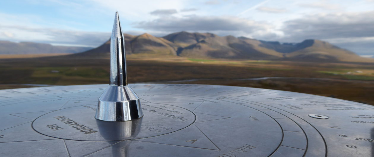
Onto the remains of a Viking fortress at Burgavicki, after a very long drive down a pot-holed gravel road , Rt 717. At the top of the fortress we found one of the many compass markers in Iceland. It shows you various points of interest and the direction they lie in.

Compass Marker at Borgarvicki

On the way we stopped to look down at Hvitserkur rock pillar, one of the iconic places you always see in photos. Tourists were doing the usual dangerously stupid things, scrambling down steep, loose cliffs. The afternoon sunlight was turning the long grasses into golden waves.

Golden Grasses at Hvitserkur
Tide Coming in And Sun Going Down at Hvitserkur

In the middle of nowhere, we saw a sign for the Vastnessnes Peninsula Restaurant so we stopped and had a fresh trout dinner before finding our stop for the night. The menu was written on a big chalk board, the bread was homemade and as usual, it was a bit pricey, but good.

Vastnesnes Peninsula Restaurant and B&B at Sunset

We camped for the night in a field at Illugustras, a farm where we followed a winding sheep path to watch some seals fishing and playing at sunset. Sheep, sheep, and more sheep trim Iceland’s grass among the rocks.

Sheep Leading us to the Fishing Seals

Besides the farmhouse, there were a couple of toilet/ sink rooms and a sweeping view over the ocean. The two bicyclists we passed earlier in the day lay exhausted in their tents nearby. Biking in Iceland is hard work with rough roads, wind and rain. When we got up in the morning, the slanting sun lit up something shining bright white out on the water.

My First Iceberg Sighting Ever!

When I zoomed in with my camera, what I thought was a ship, turned out to be an iceberg. My first! It was very far away and I hoped to get a closer view as we traveled around the fjords later.

We drove along the edges of the fjords all day and think we saw a Minke whale in Hrutafhordur. Jeff finally found a wool sweater he liked at a shop adjacent to a small knitting factory in Huammstangi. They sold mostly cheaper, machine made sweaters but his was hand knitted by a local woman. There are many sweaters sold in Iceland that that are made of wool locally sourced, but then they are manufactured in China, and they do not fit well, so be aware. The handmade ones are much nicer and worth the extra money, especially when you can help local folks earn a living. There are not many opportunities in the hinterlands otherwise.

When I mentioned to the the shop keeper that I saw an iceberg, she told us that sometimes Polar bears will ride in on them and that local fisherman always sail out to check before they get too close to land. They had been watching three different icebergs over the last few weeks. If they spot a polar bear they will shoot it before it can swim to shore because by the time they arrive, they are sick and starved and will kill anything they can catch, including people.

The ocean currents and wind tend to push icebergs into the fjords and each village hopes to be the one the bergs stop at because it brings in more tourists and money.

We spent the rest of the day driving in and around more fjords on one lane gravel roads, steep tracks with “M” turnoffs for passing. There are no guardrails and in some places it was a sheer drop on Jeff’s side, causing him to occasionally flinch. I was glad I was driving.

Jeff had made a list of interesting places, so we stopped at Holmevik Museum of Sorcery and Witchcraft. The necromancer pants are creepy and it was a strange place but still worth a visit. I liked the book of Runes, where I found my newest favorite symbol, the Helm of Awe. I made some out of clay when I got home. We need all the help we can get in the States right now.

Helm of Awe-Icelandic Rune to Protect Bearer from People Abusing Power

Our next stop, the village of Drangsness, where we saw a loon and a bunch of seals and then, the best part, three hot tubs, in the narrow strip between the road and the fjord. The tubs were three different temperatures and were filled via pipe from the local hot spring. We changed and showered across the road in the shower rooms and made a dash in the cold wind to immerse ourselves. Ahhh… There were very few cars going by and only one other couple soaking as we relaxed in the free hot water. They were from Hungary, on their honeymoon, and agreed that Iceland is clean and well run.

After our nice hot soak, we drove, and then drove some more, through a Mars like, desolate, rock strewn landscape. We finally pulled over at an overlook on the knife edge of Kambsness Point, high above Sodavik. We could see a cod farm far below in the fjord and low clouds oozing around craggy hills. It was windy up there. It seems there is always wind.

Swirls of Fog Rising Beyond the Fjord

When we made our way down into the village, on the far side of the fjord, we found a little campground overlooking a shrimp packing plant on the water below. Next to the camp we found a playground with a cool little zip line, built in memory of an avalanche event in 1994 which took out some 20 houses, killing 14 people. Only one other couple was staying in the campground that night and the 7 degrees C (46F) felt colder once the rain started falling.

The shoe box sized diesel heater in our camper van did a great job when it was cold and damp outside. All we had to do was push a button by the sink and a little electric fan under the passenger seat started up, along with the sound of a tiny 12 volt diesel fuel pump pulsing to life. Click, click, clicking away. In just a couple of minutes the van was warm and we could shut it back off. I would rather snuggle into blankets than listen to the snores of a fuel pump.

Tuesday Day 11, Sudavik

The little Sudavik Arctic Fox Museum a few blocks from camp was our first stop of the day. They have two live foxes in a pen outside that were not thrilled to see us, staying curled up like dogs in the cold. We sat on a couch and watched an Artic Fox video and then wandered around the displays. I had thought all Arctic Foxes were white, but it seems there is a genetic difference between the white ones, that live on snow pack, and the brownish grey ones, with their more rocky, shore habitat.

Back on the road, we came to a sudden dark hole in the hill ahead of us, which turned out to be a 6 kilometer long tunnel through a mountain. I am not fond of tunnels and the drawings of a man running back away to safety along the walls was not helping. Midway through, we came to an intersection with another road and the running wall man switched directions to lead us out.

Emerging back into sunlight our van climbed up the next steep, rock strewn hill (no trees, remember?) called Hrafnseyrarheidi. (Just try and pronounce that.) Pausing at the summit, we got out in the fog to stretch and look around. Two other couples stopped, one who just happened to be from our neck of the woods, in West Virginia , and the other from Wisconsin. They told us that a hurricane Florence was on a track right for our home. We tried not to worry, but kept checking the weather app on our cell phone after that. Luckily, it mostly passed us by and our house and critters were fine.

Dynjandi Waterfall

Hiking up the Dynjandi waterfall later, we passed a girl on the trail dressed in a really strange fur costume with a shimmering blue dress and an Arctic Fox mask. A whole entourage of photographers was with her. I wish I had gotten a picture. She was bizarre. The biggest waterfall was way up near the ridge, wide, but very shallow. The day turned bleak, rainy, cold and grey. We didn’t see any sheep, just a few too many people.

Going around the end of yet another fjord, Sodurfirdir, we stopped at a hot pool, but the tame, blue concrete pool close to the road was too cold and the wild spring up from it was too hot, so we just ate lunch and hoped for a better one later. A local couple, also stopping for lunch, agreed.

Wild pool, too hot…

We drove on to Bildudalur and the Sea Monster Museum/ Tea House , where I found a random, beautiful blue , cap sleeved Icelandic wool sweater knitted by a local woman named Hedrus. I paid cash of 162 ISK so the crafter would not have to pay 25% tax to the state. We had a nice hot cup of tea and a biscuit then toured the tiny museum. The interactive monster map that operated like air hockey was cool.

Talknafjordur was our next stop. They have a good hot pool that the locals all use, way down a dirt road, tucked into the hill side, overlooking the fjord. There were three small, square concrete pools with three different temperatures. It was very basic, but there was still a shower/ changing room at the side. The water was perfect in the medium pool and even better in the hotter one after we warmed up. We talked with a guy from Faroa Island who works at the nearby salmon hatchery, raising fry to stock the local fish farms. The girl with him also worked there and will not eat fish. The one hot spring feeds the school, the library and the town pool, but there is not enough to heat the houses. Most towns seem to have geo-thermally heated community pools, but when this village drilled, hoping for a larger supply, they got 70 degree air and no water.

The museum in town used to be a packing house for green beans and chick peas shipped over from Europe for packing and then back out for selling, which seems bizarre to me. Next door to it there is Icelandic Minerals, a Calciferous Red Algae processing plant that makes feed supplements, vitamin pills and water filter materials from seabed deposits of dead algae . It has replaced a fish processing plant which shut down due to various fishing quotas instituted since the 1970’s. Often controversial, the sustainability of the fisheries has improved but individual fisherman have issues with large corporations taking over and many people had trouble adapting to the changes. It is complicated.

That night, we had dinner at the Hopid Restaurant while a major soccer match between Iceland and Belgium played on all the TV screens. The place was packed with soccer fans and looked better inside than out. I had delicious smoked trout that looked like salmon, with roasted potatoes and salad, covered in green and red peppers and cukes. Icelandic greenhouses grow a lot of cucumbers and they show up in everything, including the sub sandwich we ate yesterday from the gas station.

We ended up camping in the parking lot of an old grocery store where a kitchen and shower area had been carved out of one tiny corner and some computer geeks worked out of a tiny room next to it. Very strange place, but it worked just to sleep. Ran into the honeymooning couple we had met in a hot spring earlier.

Day 12- Bird Cliffs of Latrabjurg

In the morning we drove out past the Salmon farms, down a narrow gravel road carved into steep cliffs, to what was supposed to be a red shelled beach but which turned out to be orangey sand. We were amused to see the farmer take a busload of tourists on a hay wagon tour of the beach, taking the scenic route around the tidal pools. He also had some really sweet looking wooden camping hut rentals, made of heavy tongue and groove 2 x6 pine. We walked on the wide beach, looking for shells and enjoying the solitude. The tour group was way down the beach away from us.

Wide, Flat, Not-Red Shells, Beach

Coming through a tiny fishing village on the way, we slowed for this guy holding a speed limit sign- not that we could have gone fast even if we wanted too.

Road Sign Safety Dude

Our next stop, the Latrabjurg bird cliffs, are a major attraction during Puffin nesting season, but during September they are beautifully serene. It started out cold and foggy but the wind drove the fog away and the sun colored the sea a shimmering pewter. Good rain and wind gear are essential for a good time in Iceland. It is not rainy continuously. The sun comes and goes all the time, but the wind is pretty constant it seems.

See, just down the road is sunlight and blue sky!

We got back in our van and drove around the end of many more West fjords, stopping at stone trolls, old churches, remote farms, and eventually at Vatnsfjordur Nature Preserve. We were hoping to get in a soak there, but there were too many people, all from Spain, crowding the hot pool below the road.

Stone Troll

We headed for a campground at the Laugar Hot Spring instead, on the hill behind what used to be an all girls school. The campground facilities were mostly closed up but we parked to use the hot pool, a round, stone laid pool sunk in the hillside up from the dormitory.

A perfect hot tub

There was one Israeli couple and one Tasmanian couple in the water already when we joined them for a nice soak. They took a group picture and we all compared our countries and our Iceland experiences until almost dark.

We still needed a place to camp for the night and were hoping to stay at a place near an old Viking settlement outside Buoardalur, but we found it was no longer a camp, so we ended up at the campground in town, in the front yard of a daycare center, under horrible dusk to dawn lights. The absolute worst campsite so far. There were way too many people and they were all loud. We had gotten used to having almost no one around.

Day 13- Snaeffellsness Penninsula

The next morning we went back down the road where the Viking Museum was and just missed getting a look inside the cool sod hut. It was closed for the season except for a special tour group that was just leaving. We could not convince the guide to let us through. He said he had another job that he had to get back to. We and a couple from Scotland had to settle for walking around and reading the information plaques about Leif Ericson’s father (Eric the Red) who was apparently disliked by everyone that had ever lived near him. It was cold and windy and we did not stay long.

Blueberries, lichens and moss

Onward to Snaefellsness Peninsula on Rt 558, and a detour on a track through a lava field with cinder piles covered in mosses, red lava and cool formations. I love that mosses and lichens are the first beginnings of making soil.

We drove through Kirkfell Village but the fells was too crowded to even stop, with police directing a traffic jam out of it. We kept going until we saw the Helissandu Maritime Museum. They were friendly and willingly talked about the displays and we enjoyed tea and scones with them. Outside we did a walk through boulders and looked into a little soddy building.There were whale bones and some round boulders that you had to be able to lift before you would be allowed to go to sea, in olden times. We were not able. Instead we meandered through the village and came across an old warehouse that had been totally covered in beautiful hand painted murals. What a great way to make some seriously ugly empty warehouses come to a meaningful life.

Hellisandu Murals

We continued on, expecting to see a glacier at some point, but the clouds hovering on the hills kept it well hidden. We hiked out a sheep path to the beach through huge round boulders and found bits of old steel shipwrecks. We finally caught a glimpse of the glacier on the way back out.

Hellnar Beach, down the road, was too cold and windy to even consider getting out of the van, so we drove on to Arnarstapi, where there is another giant troll rock sculpture. It was very windy but the pathway around the sea arches and then the little protected harbor around the side are worth getting out for.

Volcanic Sea Bridges

Jeff had wanted to maybe visit Song Cave but it was way down an “F” road so we were not allowed to drive it in our rental van. The road did look pretty rough. We went to Reynaulds Canyon instead, which is a crevice in a high rock hillside with a skylight in the ceiling and a stream coming out through it.

Entering the crack in the wall

The wind was seriously stiff as we searched for a campsite and we drove until 8:45 that night looking. Finally found Snorrastadir Farm. The kitchen barn was big enough for an army to camp in and it was the most expensive night so far at 50 ISK. We were glad we were not in a tent as the wind was likely to blow them away.

September, Day14

Snellfesness Glacier appeared from under the clouds as we drove away from our camp in the morning, the coldest windiest one so far. We stopped in Borgarnes for gas and groceries and toured the Settlement Center Museum, which had good sculpture and artwork depicting the Epic Saga. They hand you earphones and send you on by numbered stations to listen to each telling along the way. There was a great dragon sculpture outside over looking the harbor.

We drove North on Rt 1 and East on 52 to Deildartunguhyer (just try and pronounce that!) where there is a humongous boiling hot spring and power generating station. Next door was a fancy Spa and a commercial greenhouse that was not accessible.

I really want to see inside a greenhouse as I am interested in how they heat them here. I searched google for geothermal greenhouses and found one, where I bought some strawberries, but they were just single pane glass with steam pipes the same as we had in the U.S back in the 1950’s. I am hoping for state of the art greenhouses. Seems like with all this free hot water they would have hydronically heated floors.

There was a spa near the power plant and an another off-limits greenhouse, but I am happier with wild hot springs and not paying big bucks for fancy stuff.

Reykholt and the Snorri History and Research Center came next. The museum was a good place to learn background stories and they had a nice round, stone-lined hot pool and a greenhouse on the grounds, but the public is not allowed to soak or visit the greenhouse. The doorway in the hill leads to a tunnel into the original mansion where the museum is now. As we walked the gardens, we could see hot vents all around the area, up and down the valley.

Tunnel to the hotub and for escape back in the day

Next stop, Hraunfossar Falls, where, for close to a km, horizontal layers of water emerge all around the cliffs through the volcanic rocks, falling in sheets and falls everywhere. The pools down below are a gorgeous blue and the wind just kept coming.

Weird to see horizontal lines of waterfalls

Back to Hamrar, where we saw mini steam plants in peoples backyards. We were going to see trolls of some sort in Fosston but it was just too windy, so we drove on looking for a campground for the night, finally finding one way down a gravel road near Saurbaer, on a lake. We were the only campers there. We were greeted by border collies and a caretaker who was surprised to see us, being off season. This was the clearest, coldest night so far and there were no lights of any kind to disturb the night sky, so we were hoping to finally see the northern lights.

It got cold fast as the sun set and when it got full dark I went out to check for the lights and actually saw them! I rousted Jeff out and he stood out there with his camera taking pictures for a good long while. The lights were easier to see on the camera than with our eyes for some reason. It was too cold for me to stand out there long, so I watched through the window, huddled in blankets. They were just wispy cloud looking apparitions floating around over the hills ever now and then, not really colored much at all. They were still cool and I am glad we finally got to see them. Northern lights were on my list!

In the morning there was frost on the ground and a bunch of chickens were pecking outside our door. We packed up and drove around yet another fjord, where the U.S. Navy once had a barracks and anti submarine station from WWII. It is amazing, some of the out of the way places we have found U.S. military installations.

We continued out a wide gravel road in search of a waterfall where I dropped Jeff off and circled back around because it was too crowded to park. I explored a quieter place down the road and came back for him.

Yet another beautiful waterfall

Next stop was the Cave People site, where smooth lava had been carved out of a hillside to make a little house where people used to live. There was also a Lava Tube tour starting from there but we did not go on that.

People carved a home out of soft lava rock, installed a chimney and furniture, and lived there.

After wandering around the strange smooth lava layers, we drove out through Pingvellir National Park again, but it was really crowded today and we did not stop. It was like being down on the Cades Cove Loop in the Smokies on a bad day. Glad we saw it earlier.

Finally found a greenhouse in ReykholtI that we could tour, the Friedheimmer, where they have a restaurant and pub right in the greenhouse. Beer! We wandered around looking at the way they grow tomatoes on long strings, using imported ( from Holland) boxes of bumble bees for pollination and steam pipes running around exposed on the walls and across the floor. I am so disappointed that in Iceland they do not design greenhouse to be efficient. Single pane glass, exposed steam pipes, High Pressure Sodium and Mercury Vapor lamps. They have not had to learn to be efficient since their heat heat is free and is basically just waste heat anyway. I had imagined that they would have modernized more. At least this cold bleak country is able to grow some of their food using their natural resources.

Freidheimmer Greenhouse, and food

We partook of some tasty, premises grown, tomato soup, beer and fresh bread at the bar while we were checking the facilities out. Fascinating even though it is not state of the art.

Next place was supposed to be the Kenio Crater but it was too windy and the rain was driving sideways so we did not stop. Drove through Selfloss and Eyarbakka to the coast where it was even windier, 5 degrees C and raining hard. Not fun to drive in. Kleifarvatn Lake had huge waves and blue water surrounded by smooth black lava banks. We stopped at the mudpools but it was not worth getting out in that weather. We continued on to Grindavik, which had no campground, and it was so windy when we were trying to walk around the steam vents that we had trouble staying upright. It was a very short visit. I am not into being blown into a steam vent.

We drove the coast road looking for a camp gound and stopped at a little roadside park where the Eurasian and North American plates meet. Still trying to find a place for the night, we stopped for a bathroom break at a Bonus grocery store that had only one toilet and no paper and really grundgy facilities. The Vogar campsite was too dismal to even think about so we kept going.

We ended up at the Hafnarfjordur Campsite at 7:15 P.M. There is a shower and we will be able to get cleaned up and packed in the morning before heading out to the airport, which is not far away. It is a good place to spend the last night. We could not believe any planes even flew today with the wind we’ve had. Glad we weren’t on them.

My Favorite Icelandic Sheep

Iceland has had the coldest, wettest summer in recorded history this year, according to the locals, although more extreme than what we have experienced in West Virginia. It has been so wet in Iceland this summer that they were able to export hay to Germany and France for the first time ever, while they experienced a drought over there.

We drove about 2300 miles on our trip through Iceland and did not even venture into the city of Reyjavik. We enjoyed meeting all the people we came across and imagining what it must be like to live in the more isolated places during the winter months. Icelanders are a hearty people and friendly. We had a wonderful time exploring all the wild places and I am especially fond of all the hot pools. And the sheep. And the soddy huts. And the waterfalls.

I highly recommend visiting Iceland by caravan if you get the chance.

Waiting for the airport bus to take us home.
-Wendy


Iceland Post 4- Days 5-8

Diamond Beach Ice
Diamond Beach Ice

Diamond Beach

The road at Diamond Beach and the lagoon across the road was under construction as we manuevered around soggy mud holes and gravel piles to park near the bridge over the river. Lots of people crowded the area as we donned our boots and wind gear and then made our way through the black sand down to the beach. Mini icebergs lapped at the shore and seals played in the mouth of the river. Bits of ice sparkled all over the beach and photographers vied for position to catch the same photo as everyone else. Some idiots were getting wet in the frigid waters just so they could get selfies with floating ice. Can you tell I don’t like crowds?

Lagoon Across From Diamond Beach
Lagoon Across from Diamond Beach

We wandered up stream and under the bridge to the lagoon on the other side of the road where people were more spread out. Lots of seals skimmed through the water around much bigger icebergs that were trying to make their way out to sea, ever so slowly. Flocks of birds perched on icy berg beaches, squawking as tourist boats came too close. I liked watching the seals fish but the rest was too much. We got our pictures, loaded into the van, and drove through some more rain into the Netto store at Hofn for another $87 ISK worth of groceries.

Djupivogur

Fishing Boats
Fishing Boats

In Djupivogur, a small fishing village, we paid $35 ISK at the upscale motel for our nearby campsite overlooking the harbor. There were some large round wooden huts that looked like giant wine barrels laying on their sides and one teepee you could rent also.

Wine Barrel Hut
Wine Barrel Hut

We got there at dusk and followed a path up the little grassy hill behind our parking spot which skirted around a rock promontory. At the top we sat and enjoyed a 360 degree view of the peninsula, the sea and the fishing boats in the harbor as we watched the stars appear in a clear sky.

Campground View

The kitchen block was filled with people cooking dinner and lounging on the 2 sofas while charging their phones and laptops and we hung out for a bit with them downloading our own camera cards and looking at photos. It was a good thing we had our own cook top in the van since there was no extra room at the stove. We cooked up some couscous and cheese omelets back in the van and turned in for the night.

Thursday, September 6th

We slept late and did not get on the road until 9:45, after our usual bread and jam, Skyre and granola, hot chocolate and coffee breakfast. We snacked on peanuts ,almonds and butterscotch Wurthers while driving the narrow roads around 4 fiords and then disappearing into a hole in the mountain for the 6 km long Faskrudsfgordur Tunnel. It was the first time I had ever been in a tunnel carved out of volcanic rock with an intersection midway through it. I was glad to emerge into daylight.

Gravel Roads Around Fiords

We continued overland to Egilstaddir and on to Seydisfgordor, which was supposed to be an artists town. All we saw was the ferry to Europe and a large fish factory of some sort. There were also some cool murals.

Murals

We followed steep, windy, single track, dirt roads looking for the Dvergastein, a dwarf rock said to have flown across the fiord to land next to its church , which had been moved from the other side. We never did find it but think it may have been behind a house we passed that did not look all that friendly. Instead, we stopped at a nearby ruin and walked to a nice little waterfall.

Looking for the Dwarf’s Rock

We backtracked to Egilstaddir to to fill the van with diesel for 12500 ISK (about $106 US ) and headed up Rt 1 and 862 towards Dettifoss and Selfoss.

Dettifoss

These two waterfalls are the size of Niagra and carved out of solid rock. It is mesmerizing to watch and listen to the powerful force of all that water spilling down into the giant crevass below. We drove through black volcanic rubble with no plants and not even a sheep for 166 km! Bleak. Grey. We wanted take the road through the National Park but were not allowed without 4-wheel drive. In Iceland, if they say you need high clearance and 4-wheel drive, you really do.

Steam Vents Hissing

We adjusted our plans and headed towards the geothermal hot pots and steam vents at Namafjall. The midges love these hot vent gasses. We enjoyed a beautiful sunset against the golden sulfurous colors (and odors) of the desert landscape after daytime temps hovering around 14 C.

Sunset Over Sulfurous Vents

In the far distance we could see the huge Herdubreid Volcano, topped with its glacier frosting.

Herdubreid Volcano

Our last stop for the day, Myvatn Lake (Lake Midge) to Vogar and our 4000 ISK ($32.50 US) campsite for the night. Three inch Lava rocks were floating in the water, coming to shore with the tiny lapping waves at the pull off. Steam vents sent up little puffs of smoky gasses all along the sides of the surrounding hills. We settled in and I cooked up some spaghetti with ground beef (major splurge at the grocery store) sauce and fresh broccoli for dinner. We are hoping for a cold, clear night and the possibility of some Northern lights.

Friday, Sept 7

We woke to a beautiful sunny day about 15 C and drove to Dimuborgir (Dark Fortress) and walked the blacktop pathways around to the Yule Lads cave hideout.

Then on to the walking trails around Hofte Forest on the Lake and Kalfastrund, where there are volcanic made pillars of rock jutting straight up out of the water.

And sheep everywhere…

My Favorite Icelandic Sheep

Driving towards the Krafla Geothermal plant, we came across a sink and shower by the side of the road, complete with a towel hanging there. Bizarre. Natural Hot water coming right out of the ground funneled into a shower head for all to use.

Bizarre Hot Shower and Sink By the Roadside

Right up the road we stopped at Viti (Hell) Crater Lake, in the center of an old volcano cone.

Next, we stopped at the Grjotagria Park hot pool in a lava tube cave situated along a rift. The water has gotten too hot for people these days (above 51C) and there are signs forbidding swimming, but you can still explore a little bit inside the tube.It was pretty steamy in there so I came out but Jeff stayed and checked it out.

On to Jarbodin nature baths where the leftover water from the steam plant fills huge outdoor pools and a smaller rectangular hot tub holds at 41 C. The green link has good pictures. You have to pay a facility fee here, shower first and then put on a suit before getting in. They will even bring you beer. It was not crowded and there were underwater benches to sit on and you could move around the pool to different temperatures. We enjoyed it, but I like wild ones better.

Humpback Whales

We wanted to see some whales while in Iceland so we drove to Husavik next and signed up with North Sailing Whale Watch for 9:00 the next morning. Our campsite overlooked a kids soccer pitch on the hill above town. It was getting windy and cold as we turned in after warming up leftover spaghetti for dinner.

Whale Watch

When we boarded the big wooden boat the weather was mostly nice, but windy and cold with clouds scudding about. They issued us all insulated, buoyant coveralls to wear over our clothes. It seemed like overkill until we got out on the water and then we appreciated the extra dry warmth.

Humpback Tail

We saw 3 Humpback Whales very close by, which was exciting, and then we toured a beautiful fiord in search of some reported sightings of minke whales. The house was so isolated, only accessible by water.

Up the Fiord Looking for Minke Whales

Definitely worth the cost, 10.500 ISK, or about $90 US each adult for a three hour tour. Plus they gave us really good hot chocolate and sticky buns as we headed back.

After we disembarked at the docks we toured the Whale Museum, where they have a great display of all different kinds of whale skeletons and such.

On our way again and needing another fill up of diesel, we stopped at a station in a biggish town and found it impossible to get the fuel cap off the van. I tried, Jeff tried, 3 other people tried- nothing. The locking mechanism would not budge. It was late on a saturday night, nothing was open and repair shops close down on Sundays in Iceland. We were getting panicked until I thought to ask the attendant for some WD-40. It was a plastic cap, but I figured, what the heck? We squirted some in to the keyhole on the cap and WaLa! It worked. Onward to Akureyr!

-Edgewise Wendy

Edgewise Wendy
Edgewise Wendy


Iceland in September-Post 2

Iceland Air

Our 8:30 pm Iceland Air flight from  Baltimore, Maryland to Keflavik/ Reyjavik, Iceland, was three hours late taking off. The water system on the plane was not working and the mechanics would not venture out in the thunderstorm to repair it. After 2.5 hours of sitting (with stale air) trapped in the plane,  the pilot announced that BWI had just closed the airport due to the storm. So we sat another half hour. Not the best start, but at least my claustrophobia did not kick in.

Iceland Air gave us very little information and offered nothing to us the whole time we waited. Free headphones would have been nice. We could have watched an entire movie- with sound. Finally, the plane took off for the five hour, red eye flight, and we arrived in Iceland about 9:00 A.M. Iceland time. We were tired and so ready to get off and stretch our legs.

GoCamper

the flight attendants herded us down 2 sets of stairs, fore and aft, leaving us to trudge across the cold and windy tarmac  to the terminal, where we picked up our luggage. It pays to have a jacket with you in your carry on. Our GoogleFi phones had a good signal and we called GoCampers for the 40 minute ride to our rental van.  While we waited, Jeff managed to get some cash from a kiosk using his no fee credit card, but it took three tries.

Be sure you get your pin number from your credit company well in advance. You might also want to familiarize yourself with the Icelandic Krona to prevent confusion over the exchange rate. We accidentally got more cash than we wanted. Currently, 1000.00 ISK is about $8.81, but they use decimal points in strange places. We basically found that moving the decimal point left two places gave us a rough (high) estimate of dollars.

The folks at GoCampers were quick to get us set up and we scrounged through the free box for food left by previous campers on the way out the door.  I was glad to see that this was like New Zealand, with everyone sharing their leftovers at the end of their journey, since food is very expensive on the island.

The van was a 6 speed stick shift with 10 feet of space behind the drivers seat, similar in size to one I used to drive at work, so it was easy to get used to. I was glad it was not any bigger and that Icelanders drive on the right side of the road. When we saw the meager blankets that came with it, we were really glad we had packed our sleeping bags.

Since the van did not have a toilet,  we would need to find a campground each night and partake of any facilities along the way. We discovered fairly quickly that some people think nothing of leaving their toilet paper and waste behind at pull offs, something I cannot understand, and which is causing problems for everyone.

The day was windy and cold (6 C or 42 F)with blasts of sporadic rain so after looking at the weather radar on the phone, we decided to try and get away from the  coast and drive the Golden Circle before heading out to the East along the Ring Road. The best part of renting a camper van is the ability to change plans whenever you like. We had no reservations or obligations ahead of us.

Before leaving town, we stopped at the Bonus grocery store and spent 8900 ISK (Kronar) on Skyr (yogurt), bread, lunchmeat, spaghetti sauce, broccoli, eggs, cheese, milk and juice. It all fit in one reusable bag. You will have to pay extra if you use their plastic bags, which they do not encourage. By our loose estimates, our one bag of groceries cost about $89 US dollars, although actually it was closer to $78. I had brought granola, pasta, nuts and some Ramen from home. We did not want to shop too often and were not sure how hard it would be to find a store once we got out of town. The camper van had a cooler size fridge running on 12 volt, so we packed it all in and started our trip.

Thingvellir National Park

Rainbows led us along  Route 36 to Gullfoss ( foss at the end of a word means it is a waterfall).

GullFoss

The rain was letting up when we reached Thingvellir, a place where the North American and European Plates meet, forming a natural amphitheater.

Rocks at Ringvellir National Park

This place had been an annual meeting place for the Vikings for over a thousand years and the rocks, waterfalls and vistas were gorgeous. So was the sun. It was fun to try and imagine molten rock forming the radiating rings and drip castle forms all around us. Throw visions of Norsemen at a huge market place and political tribunal in and current life ebbs away.

View Over Thingvellir

The temperature here was about 45 F degrees (7C) and windy, but the sun kept trying to warm things up. Good rain gear and easily added layers makes for comfort in Iceland. Be sure to pay for parking at this park as they have a camera recording your plate as you leave and your rental company will charge you extra for the hassle of them getting your bill. Your plate number and a credit card will be needed for the kiosk, so carry it with you.

Backdrop for Meetings at Thingvellir

Driving out Rt 37 and Rt 35, our next stop was Geysir, a hot bed of volcanic steam vents and, of course, a geyser that forms a huge bubble and then shoots up about 30 feet into the air, every 8 minutes. Click the link for a video.

We continued to drive around the golden circle, stopping at anything cool and finally setting up camp for the night at Skjol.  There is a pub attached to the bathroom block if you need someone to fix you dinner and a brew. We had to ford a huge puddle to get out to the camping field but they were obviously in the process of fixing the drainage problem. Iceland has had an unusually wet and cool summer, just like we have had at home in West Virginia. There were maybe ten other campers, so no wait for the restroom. We were tired from all the traveling, so we cooked a quick dinner of egg drop ramen with broccoli, and dropped off to sleep in our camper van just after dark, about 9pm.

Day 2

There is  a lot to see on the famous golden circle drive and today we  backtracked a little bit.  We headed out Rt 30 and stopped at a reconstruction of an old Viking sod house, which unfortunately had closed September 1, yesterday. We got out and walked around and tried not to be disappointed that the doors were closed. The  sod built structures blended into the landscape  with grass growing all over them and there was a nice waterfall close by.

Reconstruction of an Old Viking Soddy
sheep fold
A Beautiful, Round Skafholtsrettir, or sheep fold

Along the way we came across a Skafholtsrettir, or sheep fold. This is a round pen made of sod and stone walls, divided like a pie into sections with a circle in the middle. They have been used to sort all the sheep brought down from the highlands each fall for hundreds of years. This one was renovated in 1954 but then an earthquake destroyed it on June 17, 2000.  The sod and stone walls were beautifully  rebuilt in 2001 and the annual rettir will be starting this month, so maybe we will see it in action.

Waterfalls are one of our passions, so the next stop was Urrigafoss, Seligenansfoss and Gijufurafoss. Foss means waterfall.

Seljalandsfoss waterfall
Seljalandsfoss

Seljalandsfoss is quite famous and there were a lot of people there, but not so many that it bothered me. September is a good time for smaller crowds. The next waterfall, Gljufrafoss, is a short walk  away, where some folks enjoyed squeezing into the crevice to get wet. There are signs with stories about each place.

Gljufrafoss

Down the road a little way is Uriddafoss on the Pjorsa River, where salmon and trout spawn and seals come up to feast on them. The Landsvirkjum power company is planning to dam the river just above the falls and divert much of the water. Iceland is powered by water and geothermal steam  and still, like everywhere, there are issues of conservation.

Uriddafoss

We continued on, stopping at the Volcano Center, where we learned about the numerous volcanic eruptions, hotspots, earthquakes, glaciers and floods that occur all over Iceland. The entire island is actively changing all the time. It is a little scary.

Our finals top for day 2 was at Skogafoss, a beautiful  place where we camped out to the sound of the waterfall all night. There were sheep across the creek way up on the hill, and a hike up many steps to the top of the falls.   A photographer was taking pictures of a bride in her long white, strapless, wedding gown, who kept putting her puffy parka on between shots to warm up.

Skogafoss

We splurged and ate dinner at the restaurant with some really tasty, local Artic Char, sweet potatoes and a Lava Stout. I would not be drinking much beer on this trip at these prices, $11-$18 a glass.

Near Skogafoss

The mountain behind the falls had a glacier sitting on it that we could not see from up close. The sky cleared and the temperature dropped as the sun went down and we glimpsed our first sight of a wispy  Aurora Borealis, just a fleeting glance of a greenish glow over the mountain that quickly dissappeared. I was left wondering if I had even seen it. This gave us hope for other chances to see the northern lights on our trip to the north.

Stay tuned for the next leg of our 16 day Iceland trip.

-Wendy lee, originally writing from my homesteading site at Edgewisewoods, Gardens and Critters and then moving all my travel and hiking writings to my new site EdgewiseTravels .com

Iceland Route Map

Iceland-September 2019-Post 1

One of Many Roadway Rainbows


16 Days in a Go Camper

We spent the first two weeks of September 2018 traveling around Iceland’s ring road in a camper van. Sixteen days of driving to new places, exploring cool things, and meeting people from all over the world.

We were prepared for cold, wet and windy weather, which we got plenty of, but when the sun was out it was instant happiness. Iceland is a land of stark contrasts, bleak beauty, amazing vistas, gorgeous waterfalls, hellish volcanic steam vents and a resilient people.

We took thousands of photos, many through the windshield as timeline documentation and memory tokens, but also, capturing  beautiful scenery at every stop. Our first day we saw rainbows everywhere as the rain and sun competed for top spot.

Thingvellir National Park With Sunshine

Jeff did alot of research in advance, so that we sort of knew what to look for, but we did not have an actual schedule, just a list of interesting places along the way. Living out of a camper van allows you to get as far as you want to  and then look for a campsite at the end of day, wherever you happen to be. No reservations required.  Since we were at the very tail end of high season, we were a little worried that some campgrounds would be closed for the winter, but it was not a problem.

Many of the farms, especially on the far east coast, have set up guest houses for extra income and some of them have camp sites as well. Not all of them are winterized, but I think getting around to the far reaches of the country in the winter might be difficult anyway. There are many one lane gravel roads with steep drop offs and no guardrails. Tourists could be a major hazard in the winter and you would need four wheel drive. The center of the country requires 4 wheel drive anytime, and a guide, so we did not do any of that. We would have needed more time and alot more money.

A Good Gravel Road

We rented a supposedly 5 person van from Go Campers, mostly because they were already out of the 2 person model when we advance booked in June. It was a 6 speed manual transmission diesel, with a 12 volt icebox, a sink, a one burner camp stove, a comfortable queen sized bed that morphed into a sturdy table and benches, and best of all-it had a small 12V diesel heater to take the chill off when we were parked. We thought it would be too big but it was really nice to be able to stand in the cooking area and be able to cook and hang out inside, especially since it was often chilly and rainy. I cannot imagine living with 5 people in there, however. The bunk above the table had no headroom and was good for clothing storage but little else. It took me 3 days to learn not to hit my head every time I sat down at the table.

Our Go Camper Home

We were seriously glad we packed our sleeping bags since the 5 little blankets that came with the camper were not substantial enough to keep us warm. We used every blanket, plus a pack towel, plus got in our sleeping bags, and wore flannel pajamas or long johns almost every night. We turned the heater on while reading and getting ready for bed and then again in the morning to warm up the space before we emerged from the covers. We are used to sleeping cold with fresh air and did not want to risk any fumes coming in.

Iceland Route Map

Jeff used his GPS and mapping skills to draw the routes we traveled, using a different color for each day. There is some overlapping of colors where we backtracked. We started outside Reykjavik (we never did go into town) and drove the nearby Golden Circle, then continued counter clockwise around the Ring Road, redoing part of the Golden Circle on our last day.

The south coast was much colder and windier than the North, which we thought odd, but we had the right gear for any weather, so it was all good. Good rain and wind gear is important, as are varying layers of fleece. I brought fleece lined snow pants that I loved, a vest, a jacket, gloves, ear bags, fleece hat, rain jacket and pants. I used it all. Waterproof hiking boots and a pair of comfy slip-ons are a must.

Our big, microfiber pack towels were useful, dried really fast, and took up very little space in our two suitcases. We soaked in 5 different hot springs while traveling around and it was cold outside that water, standing around in a wet bathing suit. You have to shower before getting in the town springs.  Getting out was not so cold as the getting in, as the heat we had absorbed stayed with us for about 30 minutes. I wish we had hot springs like them close to home.

We enjoyed Iceland and it’s people. In the next few posts I will show you where we went and what we did so you can be sure not to miss the good stuff when you go.

-Wendy lee, now writing hiking and travel stories at EdgewiseTravels  and homesteading, critter type stories at EdgewiseWoods, Gardens and Critters

Edgewise Wendy

First Day Hike_2019

First Day Hike 2019

We always take a hike on the first day of each year. It seems a good start towards optimism about appreciating earths beauty, taking charge of our health, spending time with friends and just plain getting out there. The couple that usually goes with us called before we left to meet them to tell us they were fighting the flu so we ended up going alone instead. We could have stayed home but instead decided to do a hike closer to home that the three of them had done without me over Thanksgiving, while I was away at my sister’s.

We drove about an hour south and west to Star Tannery, Virginia and then onto gravel route 609 to the ridge crest and a trailhead for the Tuscarora Trail. It runs along the West Virginia / Virginia line and we were the only ones parked. Grabbing my day pack and wearing a long sleeved shirt, vest, and fleece jacket with a wool hat, we headed North up the trail.

I had my rain jacket just in case since we have had nothing but rain the whole past year, a total of 68.31 inches. That is twice our normal. Clouds were scudding by, some dark, others wispy with spots of blue showing through. It was hard to tell what the day would bring.

Light and Dark Clouds

It did not take long to start warming up, zippers going down, hat off occasionally. The woods were fairly clear of undergrowth and lots of loose sandstone rocks made the walking careful. A breeze was blowing from the southwest and the clouds were moving fast. After about 8 tenths of a mile we came to Eagle Nest Rocks and climbed out to get a clear view of the hills and valleys of Virginia. We could see a few houses scattered in the woods below but the trees were thick enough that we could not see the road in to them. It was quiet up there with just the sighing of the wind through the trees. Jeff thought we might turn around at this point but I voted him down. It was not even worth the drive to do a hike that short. You couldn’t even call it a hike really, even if it had been uphill most of the way so far.

We kept walking along the ridge, kind of level trending towards downhill for a couple of miles, and came to some cool rock outcroppings, laurels, and views to the West Virginia side. The light kept changing, lighting up the tree trunks close by but with a backdrop of very dark clouds. The east side of the rocks would block the wind and we munched on some granola bars and sipped our water in peace.

Tree Trunks Lit by Sun

What is That Sound

After we had walked for another mile or so, I started to hear a high pitch, swooshing sound and was trying to locate the source. Some kind of telecommunications tower was over in some young pines and the support wires were singing in the wind. There was no path to get closer so we kept on going north. More rocks, more views, mostly just quiet, peaceful woods. It was in the high 40’s and a beautiful day.

Tuscarora Sandstone

As we walked on, I started hearing more singing in a different pitch, bigger and strange. We emerged from the woods into a cleared electric right of way with giant high tension power lines running through it. One tower was bigger than the others, catching the stress of a turn in the lines and it was humming and singing from more than one place in it’s humongous self. The trail passed under the towers so we kept walking, even though I really do not like to be near those things. We could hear stray electricity sparking through the air which always makes me want to grab a fluorescent light tube to see if you really can light one up from down below with just stray power. I have to try that someday.

According to our map there was a place called the Pinnacles up ahead that we had made our goal. Actually there were a couple places nearby with the same name which was odd. We walked through more woods and could see some rocks on the next ridge but the path turned away from them and kind of meandered around looking kind of boring. We turned around after we had gone further than it should have been, passing a USGS elevation marker and then going off trail towards the rocks we had seen.

The deer obviously thought it was a good hang out spot, with droppings and flattened plants all over, but the rocks were not all that impressive. I climbed to the top of one group and got a photo of some feldspar colored rock and lichens but it turned out to be not much of a view and we headed back towards the truck.

Feldspar Color

The walk in took us 3 hours, since we stopped to check out all the rocks and views, and the return trip took only 1 hour and 40 minutes.

Not the most exciting hike, but worth doing, and a great way to spend a beautiful day outside where it did not rain on us even once.

Click the links below for more hikes and maps and such. No strings attached.

https://www.alltrails.com/explore/us/virginia/star-tannery

https://www.hikingupward.com/GWNF/EagleRock/

-Wendy lee, writing at Edgewise Woods, Gardens and Critters

Edgewise Wendy Inside

Iceland 2018-Post 3

September 3-Waking Up at Skogafoss

We were awakened from our peaceful slumber at 6 a.m. by a pack of rowdy tourists with no regard for sleeping campers. They pulled in right next to us and proceeded to smoke and horse around while leaning on our vehicle. We packed up and left. Looking back, we got our first view of the glacier sitting up on the mountain behind us.

Near Skogafoss

The museum that we wanted to see  was not open yet, so we drove down the road towards the Seljavellir hot spring for a good morning bath. We drove up the cove for a ways, parked and then walked up a bleak looking draw that we would have never bothered with unless we knew about it.

Bleak Looking Morning Stroll to Seljavellir

It was cold and grey but we grabbed our suits and towels and headed up the footpath. I had not even had coffee yet.

Seljavellir Pool

There was a changing hut and a cement pond built into the base of the rock which oozed hot water, and a pipe at one end bringing in more from another fissure. About 15 people were already there and we wasted no time getting in.  One couple was from Richmond Virginia and we traded ideas while floating around. It was not the cleanest looking pool but a little algae didn’t bother me. It felt great.

Soaking in the Hot Pool

This was a much better start to the day. Afterwards we went back to the, now open, museum. The sun was finally coming out through the clouds, casting a green glow on the musem’s sod farm buildings and houses.

Sod Buildings at Skogar Museum

When you enter, all sound is muffled by the thick stone and sod covered walls and you can imagine them being snug in the winter months.

Thick Soddy Walls at Skogar

We learned that wood has always been scarce in Iceland and people depended on driftwood from shipwrecks and logs floating in from Siberia for the building of doors and furniture.

Driftwood Windows and Door on Soddy

Inside the Skogar Museum were a lot of cool artifacts related to sheep farming, spinning, weaving, fishing and wintering. One display was about the Yule Lads, an Icelandic  Christmas tradition.

Signage in 3 Languages

List of Yule Lads in Christmas Cupboard

Some of the Yule Lads

Sheep Riding to Market in a Boat

Roads are a modern invention here, and like New Foundland, transportation has been mostly by boat. I wonder what the sheep thought of this adventure? And how well might they swim?

Dyrholaey Seaside Cliffs

Next stop was at Dyrholaey seaside cliffs, where we saw a large Minke whale swimming dangerously close to the beach and some seals riding the waves.

Whale at Dyrholaey Beach

It started to rain and we moved on again.

Dyrholaey Cliffs Beach

Black Beach- Reynisfera

We love geology and wanted to see some Columnar Jointing so we drove to the Black Beach at Reynisfera. Lots of people here, so glad it is off season. There was still a wedding party and a drone hovering above though.

Columnar Jointing and Jeff

The formations are huge and the possibility of a giant sneaker wave coming after you is apparently real. The pebbles (not sand)on the beach are all polished black lava and flow through your fingers sounding like a clean rain stick.

Black Beach

We continued on, gassing up in Vic and looking for a sweater for Jeff, but all we saw was stuff made in China. Some of the sweaters said the wool was sourced in Iceland, but still made elsewhere. We are holding out for Iceland made.

Volcanic Ice Flow

We drove along the coast until we came to an area that looked like a humongous herd of sheep had laid down, turned to stone and grown moss over themselves. Then a pull off marking the spot where a village had once stood but every single person had been killed by an eruption and cairns of rocks and flowers had been built in memory of each one. Iceland has its share of live volcanoes. devastated by a flood, with twisted remains of a bridge and a scoured landscape. In 2010 there had been a large volcanic eruption under a glacier, causing an extremely fast melt and expulsion of sulfuric acid gasses, ice, ash water and rocks which tore out a huge flood plain and disrupted airplane traffic in Europe for days.

Camped at Kirkjubazjarklaustur in the rain at 40 some degrees F.

Sept 4-5 Skaftafell National Park

We woke to the sound of rain and sheep. There are sheep everywhere in Iceland.

Sheep and Waterfalls are Iceland

I boiled water for hot chocolate and coffee, ate some bread with lingonberry jam and we drove east out route 1.  We stopped at a few roadside waterfalls and drove on to Skaftafell National Park, where it had stopped raining and we signed up with Iceland Mountain Guides for a 4.5 hour glacial hike. Kyle, our guide was from Singapore and was able to converse with the older Chinese couple who had zero English (nor any Icelandic). He showed us how to use crampons, so we would not slip on the ice, fitted us out with climbing harnesses and ice axes and we drove in a big off road bus to a nearby glacier.

Heading to the Glacier

The usual glacier was deemed unstable so we had to go to a lesser one but it was still cool. Our little group moved very slowly but we got a chance to see blue ice, and climbed through icy fissures and, connected to a rope, we each went down into a hole.

Our Glacial Group

The day was grey but stayed fairly dry. The glacier had a mushy top layer which kept us from slipping much but is indicative of them melting at an alarming rate.

Melt Pool

We camped at the park that night, making good use of their brand new shower building, and woke to sunshine and a good hiking day. It was chilly so I wore my fleece lined snow pants and midway up the steep trail I got seriously overheated. I took off my pants and Jeff gave me his lightweight quick dry pants, continuing on in his long johns, hanging his ball cap for a sporan. We looked odd but it worked.

We took the Glacier Overlook( Skaftafelljokul)  trail by mistake but the views were great  and worth the additional time.

Morning Hike to Another Glacier

We hiked across open alpine terrain onto the Svartifoss trail , with more basalt columnar jointing

Svartifoss

Then down to a recently inhabited sod house over looking the glacial flood plain way down below. I love the soddy houses.

Soddy homestead Overlooking Glacial Plain

We were tired when we got back from our hike and woke to 0 degrees Celsius and a brisk wind, but there was sun!

Everyday is a new adventure and as long as you have your wind and rain gear, the weather is fine.

_Wendy, writing at Edgewise Woods, Gardens and Critters

Morning Hike to Another Glacier


Kayaking Chesapeake Bay

Leaky Kayaks

Our boats all started leaking recently. We tend to hit rocks kayaking Antietam Creek when the water is a bit low, which happens a lot in the summer. When the river gauge  downstream of Burnside Bridge reads less than 2.6 feet on  american whitewater.org then it is too low to run that section. So after 24 years, my Wilderness Rascal kayak started springing leaks. Jeff’s Pungo preceded mine with a big hole in it 4 years ago,  which he replaced with a smaller one, and then recently, it got a hole too. I finally patched the first boat with layers of fiberglass cloth and epoxy and it has started to shred after one year. The latest holes, I sealed with FiberFix Rigid Patch, and so far so good. Be careful to follow the directions exactly on that stuff. I peeled off the last bit of clear plastic before I was meant to and it took a long time to cure because of that.

Using leaky boats on small local creeks and the lazy Potomac is not that big of a deal, but when we decided to rent a house on the Chesapeake for a week, we got nervous. There are too many ways for a long paddle to go wrong with poor equipment.

We began searching  online for the Wilderness Systems boats that we like and finally found them at the Appomattox River Company down near Farmville, Virginia. We wanted ten foot long, fairly stable Class I and II (occasionally III) rated boats with good storage and comfortable seats. It was important that they track well in flat water, so they needed a keel, but we also did not want the keel to get all beat up dragging over rocks. We ordered a midnight blue Aspire 100 for me and a slightly larger Aurora colored  Aspire 105 for Jeff. They have a drop down skeg for deep, flat water and two inverted keel channels to glide over rocks and handle in shallow water. The two kayaks arrived via truck, in fine shape, 4 work days later,  all wrapped up in big sheets of cardboard, 6 mil plastic and packing  tape. I pulled off all the tape and used the cardboard as mulch in the blueberry patch. The electric meter reader laughed when he found me sitting in my boat on the grass as I adjusted the comfy seat and foot pegs. This boat is so much more comfortable than my old one. The foot pegs move easily along their track, the cushioned seat and backrest tilt and move up and down, and the seat drains.  I was down to baling twine on the old one and often had to sit in a puddle after a lap splash.

On to the Eastern Shore of Virginia!

My Honda Ridgeline truck has a four and a half foot bed when the tailgate is up, so we loaded the two kayaks on the roof racks. The cockpits are a little bigger on these boats and we had to face them out to sit on the kayak racks properly. We had our bikes on the hitch in the back. We loaded all our stuff for the week in the back seat and the under-bed trunk and headed out the road.

The noise! Something was humming like a pack of hunting dogs in hot pursuit. We pulled over and tried to find the source of the un- harmonic baying but all I could figure to do was tighten the straps and tie the ends in a different place. The pitch changed to a slightly higher tune. It was pretty bad. I turned on the radio to drown it out and finally got sort of used to it with the help of an Alleve. We had a 5 hour drive ahead of us with this.

House in Crystal Cove

After stopping at a farm market for some fresh sweet corn, cantaloupe, and ice cream cones, we arrived at our beach house.

Home for a Week

It was a stroke of luck that Jeff found this house at the last minute out on Crystal Bay. The house was perched up on stilts and sat just a few feet from the high tide mark, facing Northwest over the water. The beach was sandy and the water shallow and warm, with gentle waves lapping.

View From Deck

We could see marshes way out there and some sort of structures just barely poking up. With my camera zoomed in they turned out to be duck blinds and a hunters shack. The neighborhood consisted of about seven houses, with one tiny house past ours and then just marsh, with egrets stalking the water. No people. It was perfect.

We walked through the house and decided to take the bedroom at the top with great water views on 3 sides.  As soon as our gear was inside, we carried the boats out to the beach and started paddling to the little marsh visible from the back of the house.

Egret In Marsh
Egret In Marsh

It was about 7:30 PM and the tide was still high enough but starting to ebb. It is never a good idea to enter shallow water without taking the tide into account, something we learned on the Wicomico River in Maryland a few years ago, when we had to fight a strong river current coupled with an outgoing tide, trying to get home before dark. Some mistakes do not ever let you forget.

We paddled around the marsh for about a half hour, watching egrets and crabs scuttle around, before returning to watch the mostly cloudy sunset from the deck.

Tobacco Island Marsh

The next morning, we waited for the low tide to start flowing back in, packed our boats with lunch and water and set off across the open water towards the far marshes of Tobbacco Island. It looked impossibly far but according to the GPS it was one mile and took us twenty minutes. It is just so flat. The water was shallow most of the way, rarely deeper than 2 feet, and we paddled past numerous crab pot buoys, which enabled us to feel as if we were actually getting somewhere. It is hard to tell in open water just how far anything is-at least for these landlubbers.

Hidden Fishing Shack

We paddled past duck blinds and could see a shack out in the grasses which we finally managed to find a shortcut to, a passage that would not exist at low tide. The water trail meandered around, bending back on itself constantly until I was totally turned around.

Jeff kept egging me on but there was still a time when I just wanted to head back and see familiar… anything.

Duck Blind in Tobacco Marsh

Sometimes he underestimates how long trips can take and we have endured some tense moments wondering if we would make it back by dark. We paddled to various white sandy beaches, getting out to look around and stretch a little. He wanted to go out into the main bay but the waves were too high out there to consider it without spray skirts on our boats. Whew. Glad I talked him out of that.

We cruised through marsh for almost 8 and a half miles and saw lots of Cormorants, Eagles, Herons, Egrets, Ducks and Geese, along with what looked like a beaver lodge made of grasses, lots of crabs, and a few small fishing boats way off in the distance.

Beaver Lodge?

No people. We were tired and ready to get out of the boats and float ourselves in the 82 degree water of our perfect little beach when we got back. Then a hot outdoor shower and a cold drink. Ahh…

Village of Onancock

After an exhausting day on the water we drove into the little village of Onancock, about 5 miles away, for dinner. Mallards is a restaurant on the wharf where we were able to sit outside and watch the boats come in. I had a delicious crab cake and fresh green beans, while Jeff had blackened tuna. It was delicious. I had to bring most of my Blueberry Bread Pudding home though, as I was stuffed. Afterwards we walked around town, admiring the well kept old houses and the friendly folks strolling under the large trees. The sunset as we walked across a little bridge.

Onancock Creek Sunset

Onancock sits way up a protected creek and seems like a wonderful place to live, with a playhouse, a movie theatre and an artistic community.

Chessconessex Creek

The next day we paddled along the shore up to Chessconessex Creek and followed it all the way until the end, where a downed tree blocked the way.

End of the Creek

There were some nice homes and farms, long docks and an oyster nursery (I think) along the creek. There were also some large birds, osprey maybe, with their young, up on nesting poles in the water, and Cormorants perched on old dock pilings.

Cormorants

We could not feel any current but the water was rough on the windy side so we tried to hug the leeward shore.

Our friends arrived with their boats just after sunset, driving just behind a storm that was moving North and East. It missed us.

Sunset on Crystal Beach

Pompco Creek and Long Beach Island

For the next few days, the weather was supposed to be in the 90’s, sunny and dry.  Jeff had scary big plans for this next trip. With the good zoom on my camera, we could see a house way out there, and a long white beach, but they seemed too far to reach. I was feeling intimidated by how far away it looked.

Marsh Hunters Paradise

Satellite photos showed the areas we were headed for and Jeff had it  mapped with the GPS. You would think that would make it easier to navigate through all the twists and turns but it does not. Sitting in a kayak low on the water, you cannot see over the grasses and it is easy to make wrong turns in the maze.

Can’t See the Path Through the Marsh


We kept getting into big open lake-like areas with no other way out. Then we’d be in skinny streams you could barely poke through that would open up to big water.

Another Hut Way Out in the Middle of the Marsh

It does not help that the marsh changes with every storm, so you can’t rely on a map or photo. Every now and then I would see one of the hunting shacks off in the distance, but we did not find our way there easily.  We were startled by sting rays a few times, suddenly leaping up beside us, and at one point, a boat capsized in deep water and it was tricky to bail out with no place to stand. Sometimes it was so shallow and muddy you could get stuck, and the pluff mud can really suck, but we saw lots of herons and ducks and egrets and the marsh was beautiful .

A Very Narrow Marsh Trail

After many wandering turns we found the right route, which eventually brought us out north of  Chessonessex Creek and on the far side of open water. Two of us booked it across, riding the tide on the far side, and we beat the guys back by about 20 minutes. They came home and joined us, relaxing in the water, glad to be back.

Relaxation Mode

We were all pretty exhausted after about 16 miles of paddling. The trip seemed better, now that it was over.

Parkers Marsh and Onancock Creek

The next day we headed South West into open water, skirting around Parkers Marsh, watching Bald Eagles perched atop snags onshore.  We were hoping to find a way through Parkers Marsh, but went all around it without finding an entrance.

Our Kayaks at Parkers Marsh

We pulled into a beach for a break and hen started up the wide creek towards town, four miles away. Jeff and Carla wandered off exploring the marsh and left Tom and I waiting for them for over an hour, trying to keep our boats from being blown too far upstream. We could see no sign of them, no matter how hard we tried, and finally gave up and let the tide and wind push us up the creek to town. I was glad I had my phone so we could look up Google Maps and not make a turn up the wrong fork. The other two materialized not long after we had loaded our boats on the truck we had left at the dock and we all headed to the Wharf for cold drinks. It was another day I was glad we had gotten through.

Our Little Beach

When we got back to the house, we all dropped ourselves into the water and just floated around, relaxing. We thought we’d take the next day off and ride the  ferry to Tangier Island, since none of us had ever been. Unfortunately, the small boat was booked solid the rest of the week, so it turned into a day of games and reading instead. We watched a horseshoe crab vacuuming up down in the swim area and the guy tending his crab pots.

Crab pot tender

Wachapreague

A woman we spoke with in town told us we should go out to Wachapreague  for some good fresh seafood while we were here, so we made plans for that. We thought it might be close to the ocean, but there are barrier marshes and islands to navigate and no roads east of the village. A motor boat would have been the way to get out there but we were content enjoying a delicious dinner at the Island House Inn on the wharf.  The guys had fresh flounder and the gals has crab cakes. They served us warm sweet potato rolls as we waited and we shared Smith Island Cake and a Triple Chocolate concoction.

Back in Onancock

The next day, we walked around Onancock some more, admiring the flowers, and the giant Crepe Myrtle  and Magnolia trees. It is alarming to see how many huge Ash trees make up the shady canopy and I hope the Emerald Ash Borer never makes it this far. All of the Ash trees are dying at home and it is a huge loss.  We ate lunch at Mallards on the wharf again  with some excellent Mahi-Mahi tacos and Coleslaw made with Cilantro which was really yummy.

We also stopped in to the kayak guide shack next door and met Mary Burnham, an author of “Hiking Virginia”, and bought the brand new edition. She and her husband Bill, lead kayak trips all over the Chesapeake Bay, in the Florida Keys and Everglades, as well as Costa Rica. I would love to go to Costa Rica kayaking sometime.

Crab On a Boat

Our friends have to leave later today and the weather is supposed to turn rainy for the whole next week. It has been gorgeous here so far so we do not mind some down time.

We thought we might go to the Onancock playhouse to see “Kiss me Kate”, but they were sold out. I did not even think a reservation would be needed in this small town. So, Saturday we stayed home all day and watched the rain, and more rain, and then wind. The house swayed a little in the strong gusts and when high tide came in it was higher than any we had seen, covering the entire beach and surrounding the breakwater. I pulled the boats up near the front steps and tied them in case they got to floating during the night.

It is so scary to think what a major storm might do to this nice house. They have already lost all of the yard and the water came very close to the house pylons in this little storm.  A hurricane will likely do some major damage. I loved spending a week here but I could not handle the stress of owning a house this close to the water. The bay is getting higher every year and you can see in satellite photos where roads and lots are now submerged. Shorelines will always changing and it is a risk you have to take if you want to have a house on the water.

Now for the long drive back home, this time with the boats and the bikes wedged into the bed of the truck to stay out of the wind. It was a much quieter ride home.

-Wendy Maddox, writing at Edgewisewoods, Gardens and Critters

Footprints in the Sand


Nelson County Virginia-Spy Rock/ Crabtree Falls Hike

While visiting friends recently in Nelson County Virginia, I drove up Rt 56 towards Montebello at night. It is a paved road, full of curves, and once past Tyro, it climbs all the way to the top of the mountain,  crosses the Blue Ridge Parkway and winds back down the west side into Raphine. As I started the climb fog pressed in around me and the headlights did little to penetrate the soup. I took it slow and was glad I was one of the few on the road.

Montebello sits below the ridge on the East side of the ridge, and the fog stopped right there. It was clear the rest of the way up. I spent the evening visiting, sipping wine,  and soaking in my friends hotub followed by a nice relaxing sleep.

In the morning I had time for a hike, and was steered towards the nearby Spy Rock Trail, which intersects with the Appalachian Trail , or AT on the ridge above, and south of, Crabtree Falls.

Note: August 2020. Spy Rock is currently only accessible by hiking in about 3 miles from the AT  trailhead on Meadows Lane Road, off Route  56.   Meadows Lane is a long, one lane access road  and is known to be rough and narrow and not suitable for regular cars, or people without back road experience. It is not passable in bad weather.

For a longer hike and no treacherous driving, you can also park and hike in from the bottom of Crabtree Falls, which is strenuous, but cooler than most places on a hot day. The falls are gorgeous and there are many along the way.

It was beginning to look like a storm was blowing in from the southwest and I was hoping to not get drenched. Three sets of people passed by heading down. It was such a beautifully comfortable Fall day.

When I got to the rock outcropping there was a woman standing there looking perplexed. She asked me if I knew the way to the top of the rock and was hoping to find her husband up there. It was not difficult  to find the trail off to the left around the base and she followed me up. She was worried it was going to get dark before they managed to get back to their car, They had walked in from the top of Crabtree Falls, parking in the Meadows up top and it had taken them more than 2 hours. I suggested they walk back on my shorter route and offered to give them a ride back to their car.

Looking West From Spy Rock

The view was spectacular and the slanting light through the storm clouds intensified the colors.  There was still no sign of the husband so I gave a good holler, which traveled out over the mountains ahead of me.

We walked around the bald granite rock but did not linger long with the storm clouds looking so ominous.

North View From Spy Rock

Back down at the rocks base we saw her husband, who had done a clockwise loop around the base, emerge from the Rhododendrons. He was glad to see us and was relieved to find there was a way to get back before dark or the storm.

Note: Unfortunately, this shorter route is now closed due to private property issues. Lawyers are involved and you do not want to go there.East of Spy Rock

We only got sprinkled on a little as we quickly hiked down the forest road and my little Honda Fit negotiated the 2 small creek crossings on the Crabtree Meadow Road with no problems. Sometimes that road is impassable without 4-wheel drive and better clearance, so I was glad it was in such good shape.

It was the tail end of a sunny evening down on the East side of the mountain and I continued  towards Arrington and Freshwater Cove for my next visits of this trip. Nelson County was home to me for 12 years and it still holds me tight.

Wendy lee, writing at Edgewisewoods, Gardens and Critters

Fall Foliage in West Virginia-October 14, 2017

Usually the leaves in Pendleton County WV reach peak fall color around October 14-21, but  the whole month of September into October was so dry this year that many leaves have dried up and fallen before obtaining their normal vibrant colors. There are still pockets of color to be found though, especially in the valleys, so you  still catch some color, if you don’t wait too long.

On October 14th, at Spruce Knob Lake, the usual magnificent reflections of color on the water were not to be had, but with the sky such a beautiful, clear blue and the temperature at 70 plus degrees,  there were no complaints from us.

Clear Blue October Sky

We have never seen so many folks fishing at the lake as we did this past Saturday, as we walked the easy, level trail around the lake, taking photos and enjoying the balmy weather.

Spruce Knob Lake from South Shore


I found that the lack of leaf colors caused me to look more closely at everything else as we walked.

Milkweed at East End of Spruce Knob Lake

Interesting textures and the odors of warm fall earth, still water and decaying plants  became more important.

Teasel

After leaving the lake we drove up the partly gravel road to Spruce Knob, the highest point in the state. We were a little sad to see that most of the trees towards the west  had already lost their leaves. The wind was not bad and it was a gorgeous view of the West Virginia hills, regardless.

Looking West from Spruce Knob

We followed a trail down  from the lookout tower that goes through some loose rocks onto a small  level meadow. The views to the east and South were excellent from there.

Eastern View from Spruce Knob

A few huge boulders you can climb on walked the meadow.

Stone Age Monster Rock

I thought this one looked like a lumbering short legged creature from the stone age. I did climb up and sit on top pretending  it was a horse sort of thing.

There were Mountain Ash on top of the mountain, with brilliant scarlet berries, dark green Spruce trees leaning out of the constant western wind, and the wonderfully textured sandstone aggregate rocks to admire.

Mountain Ash Berries

You can never go wrong with a trip up to Spruce Knob and the drive back down on the east side is paved. Route 33 East to Franklin has the Germany Valley overlook as another highlight.

Germany Valley Overlook on Rt 33

This maple was one of the few colorful trees we saw up close and it looks great with the sumac and Germany Valley beyond.

The Potomac Valley and other lower elevations should be pretty in the next week, especially since we finally got a rain last week. Even after the leaves fall, Spruce Knob, in Pendleton County, West Virginia is a magical place to visit. (Click on the Link for photos from 2016)

-Wendy lee, writing at edgewisewoods.com


Hiking VA-Compton Rocks

Shenandoah National Park-Short Hike

Compton Rocks is a cool geologic feature and a short hike off the Skyline Drive, near Front Royal Virginia. It is one of many short and sweet hikes in the Shenandoah National Park that you can do on a whim if you don’t have a lot of time. https://i0.wp.com/www.nps.gov/shen/planyourvisit/upload/north.jpg?resize=474%2C414&ssl=1

Map source: https://www.nps.gov/shen/planyourvisit/maps.htm

Long ago volcanic activity squeezed basalt up through cracks in the earth to form these long, six sided shapes.


Columnar Joining at Compton Rocks, Va
Columnar Jointing at Compton Rocks, Va

The rocks look like giant, extruded honeycombs, baked hard. The fairly level trail comes at the rock outcropping from the top side and you follow a small path down and around to get a good view.

On the downhill side of Compton Rocks

One way back up is to climb through the rubble slot canyon but there are easier routes.

Climbing up Compton Rocks

For a good view, follow the trail back the other direction to Compton Peak and stop at the roadside pull offs to gaze over the Shenandoah Valley below. While you are out that way you could go check out Skyline Caverns back down at the base of the mountain. Both are fun places to take kids.

_Wendy lee, Writing at Edgewisewoods, Gardens and Critters


Near West Virginia and Far, Far Beyond