Hiking WV-Pike Knob

Pike Knob-Old Circleville/Franklin Pike

It is February 20th, 2017 and we are not having winter. Out in the mountains of Pendleton County, West Virginia, the temperature is in the upper 60’s (F) in the valley and the 50’s where we are on Pike Knob. To get here you drive out Route 33 West from Franklin to a left on county road 18. A left branch of the road used to go through to Smiths Creek but has reverted back to being a privately maintained farm lane, even though the map we have says otherwise. The main road bears right , headed over the mountain, and was the main road between Franklin and Circleville years ago, before Route 33 was built. The road starts out narrow and graveled, until you pass the last farm gate and then it gets much rougher as it continues uphill.  You will see trees posted with Nature Conservancy signs your right.

The Last Farm Gate on Knob Pike

I get so peaceful when traveling on gravel roads in the West Virginia Mountains. The hillside farms with their cows, sheep, and woven wire fences feel like home to me. Farm gates beckon me and I can imagine living there, tucked away from the world. We notice numerous springs and drive through a small stream as we wind upward towards an old fire tower site on Pike Knob.

Peaceful Mountain Road

About two thirds of the way up the hill, big rocks jutting out of the road bed, caused us to park the car and walk the rest of the way up. A lone Subaru made the same decision not far below us.

Jutting Road Rocks
Jutting Road Rocks

As we climb, we see dark, rainy looking clouds starting to get hung up on the ridge and hope we can manage to stay dry on our hike to the 4300 foot summit. We didn’t bring our rain gear or packs on this short hike, just water bottles and cameras.

When we reach the low saddle, hanging between two knobs on the ridge, there is an intersection, where the old road bed drops down on the west side, a ridge path heads south and our trail winds to the North. The wind picks up and we can see the valley on the western side of the hill through the naked tree branches.

Valley View

Sunlight moves across the valley in small patches, illuminating a barn and fields in the distance. We continue veering to the right along the ridge, noting some recent tire tracks probably from whoever recently sawed the downed trees along the way.

Laurel Trail
Laurel Trail

We come to more yellow signage from the Nature Conservancy, asking vehicles to keep out, but allowing deer hunting and hiking, as we walk along a ever narrowing path through Mountain Laurels and pines.

Big Rocks on Pike Ridge

The trail in has not been very steep, and the temperature is warm when we are not exposed to the wind. Our jackets keep coming off and then going back on again.

Jacket Off, Jacket On

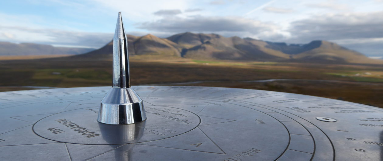
Just as we reach the highest point, we see a wooden fence and a guy sitting on the ground against it. We say howdy and he tells us he has not been up here in 30 years, when he dropped off supplies for a friend who was doing a long distance ridge hike. The fire tower is gone, with only the concrete foundation posts and the 1956 USGS survey marker left and Pines have grown up in that spot so there is no longer a view. There are a bunch of cool lichens growing on the trees though.

Lichens at Pike Knob

He tells us about the great views a little further on, out on the grassy knoll we had caught a glimpse of back in the saddle. We had no idea we would be able to get out there and are excited to go.

People Stile
People Stile

We say goodbye and slide through the people stile in the fence, heading towards the open field, called Nelson Sods. There are no trail markers but you can follow an old roadbed depression out to the meadow if you drop down to the right a bit.

The View From Nelson Sods at Pikes Knob

View from Nelson Sods

The view is amazing and the clouds are scudding on by. We can see the backside of Nelson Rocks , one of the many fins of Quartzite and Tuscarora Sandstone that are seen standing edgewise on local ridges. Further in the distance, and obscured by the clouds today, is the highest point in West Virginia, Spruce Knob. Quite often, rains do not make it over that ridge to this, the North Mountain Ridge, so it tends to be much drier.

Looking Southwest from Pikes Knob

We enjoy the 360 degree views for awhile before heading back. Along the way we remember the wall of rock that was almost visible through the woods on our way up. There does not seem to be a trail that goes there so we head out cross country through the laurels and pines. It would have been easier if we were about the size of a fox. There were a few greenbriars and a lot of blueberry bushes along the way, but we finally emerged atop some gorgeous rocks with views to the southeast.

Conservancy Rocks Below Pikes Knob

More cross country, downhill over rocks, towards the old road, and we emerged near our car. On the way down we met another vehicle turning at the farm gate and we stopped to say howdy. It was a man showing a friend the back way into his farm. He was friendly and agreed that he was lucky to live here.

Coming Down the Mountain

The weather on the east side had cleared up and the skies were getting seriously blue as we came down the mountain.

Blue Skies in February

Then we saw a Cd disk flashing in the sun a little ways up the hollow where we crossed the little stream. I had to investigate, and since it was still Nature Conservancy land, we were allowed to hike here.

Rocks Along the Way
Rocks Along the Way

There was something of a path leading to a humongous rock outcropping and it was starting to look a little cavey.

Cave Entrance
Cave Entrance

I found a shallow cave that pinched out pretty quick but it had a large entrance and a cool window.

Cave Window
Cave Window

We hiked further up the draw against the base of the rocks, checking out all the little springs and looking up at the overhanging ledges. It is so much fun to explore a place we have never seen before. I was surprised to find a little group of invasive ladybugs under a rock.

Invasive Ladybugs on Pikes Knob

We could hear water gurgling underground that did not emerge until way down slope. At one point we found a dried up fish, tied by a string from a low branch. Bear bait? Then I found a just plain pretty rock.

Feldspar Rock on Pikes Knob

Next, we found a  peacock feather tied with orange baling twine. Very strange. It was warmer here and hard to believe it was February as we scrambled over rocks and once again got in the car to leave.

Cabin on the Pike

Coming back down the mountain we appreciated  the late day sunlight hitting this cabin.

Abandoned Homestead
Abandoned Homestead

Then we felt a little sadness for the abandoned homestead in the valley. Considering it was February though, we never would have expected such a pleasant day wandering around, exploring whatever came our way. It is so nice to be able to appreciate the peace and beauty of the West Virginia mountains.

-Wendy lee MAddox, writing at Edgewisewoods, Gardens and Critters

Raven Rock to High Rock Hike

On Saturday, February 4th, we were being lazy inside when I felt the need to get outside and take a walk. The temperature outside was hovering at about freezing but the air was fresh and the sky beautiful. Jeff was somewhat hesitant and slow to get a move on, but he gave in as usual when I suggested a spur of the moment hike. I wanted to go see  Hagerstown’s Edgemont Reservoir which I had just been reading about online. Apparently, engineers had deemed the dam  unsafe and  they had drained the entire lake this past July. We had not been there in years and it was hard to imagine it without water.

We  grabbed our day packs, and drove out through Boonsboro taking Rt 66 north  to Rt 64 West at Cavetown. Here is where Jeff decided to go his way (the scenic route), instead of mine, so we did a big loop which followed Warner Hollow on a gravel road from the NE, arriving downstream at the reservoir and right back onto 491, not far from where we had left it.

The Frozen Creek in Warner Hollow

It was shocking to see the tall drainage control tower sticking up into the air at the dam end and just a small puddle of water around it,. I’ll bet the wildlife took awhile to adjust to the new habitat.

Empty reservoir with lonely drain tower

We decided not to hike there, since we basically just saw the whole thing by car. Instead we drove out to where the Appalachian Trail crosses the road a little North of there and parked on the shoulder of the road.

The first part of the trail was steep and had stones moved into place for steps in the steepest spots. Our heart rates and heavy breathing told us we needed to hike up hills more often.

Icicles were dripping down the rocks as we came closer to Raven Rocks. They looked like cave formations, with rim stone dams and bacon draperies, except clean and clear.

Icicles at Raven Rock

The rocks were large and impressive. I liked the zipper effect where one section had broken away.

Raven Rocks Zipper
Raven Rocks Zipper

We saw a couple of people and their Irish Setter out on the rocks but it was nice and quiet. I love hiking in winter. You avoid crowds and can see through the trees to the views beyond.

Raven Rocks
Raven Rocks

We checked out the rocks for a bit and then continued our climb.

View From Raven Rocks West

It leveled out  when we reached the ridge top and walking was easy. There were glimpses of the big valley to the west but no clearings to get a good view. We came to an intersection branching off to a shelter one way and a spring in the other, but we stayed straight.

Raven Rock Intersection

About a mile or so in we met a hiker in full pack who was wondering how far to the shelter. We were glad we didn’t have to sleep outside tonight. Little too chilly for that. We were nice and warm while hiking along at a good clip, but cooled off fast when we stopped.

We figured the next view point would be at High Rock, where we would turn around and head back. When we got there it was full of loud people and more graffiti than I have ever seen in one place. Freshly painted. There is a road that leads right to it from the North and it is a party spot. Supposedly hang gliders launch from there and I would love to see that, but I imagine that would draw a huge crowd. We stayed just long enough to get a look at the view and got out of there.

High Rock View
High Rock View


White Tail Ski Across the Valley

We could see the Whitetail Ski Resort, in Pennsylvania, in the distance. All the snow is man made this year. We have yet to have a decent snow and I am beginning to think we won’t get one at all. Last year we had 42 inches in one storm. A foot would be nice. We might have to go out to Blackwater Falls, West Virginia for our snow fix.

Sundown on the Trail

The sun was getting low in the sky as we hoofed our way back along the nice level ridge. We made good time, which also kept us warm. It was only a 6.4 mile hike. There was a whole group of folks that we met on the way back who were staying at the shelter that night. Guess they would be keeping each other warm. I was looking forward to sitting by our fire again.

-Wendy lee, writing at Edgewisewoods, Gardens and Critters


Reeds Creek Fish Hatchery

Weekend Board Games

For the Martin Luther King weekend we drove 3 hours out to our cabin in Pendleton County, West Virginia, taking our granddaughter Vivian with us. The weather has been so dreary for the past week, with grey, drizzly skies and temperatures stuck in the 40’s that we figured we’d mostly stay inside and play games. We had been hoping for some snow to play in.  I usually prefer relaxing with a good book to board games but games geared to a six year old are easy enough to handle, in between chapters.

All day Saturday and then again on Sunday, we played board games; Community, Gathering the Garden, Snakes and Ladders, Quirkle, and Trouble. In between we all read or listened on our Kindles. I stoked the fire, tore out and rewound my old knitting,  cooked  and read a book but eventually the fog lifted, it stopped raining, and I had to get outside.

Wet  Dry Run and a Movie

Dry Run was full of water for a change, so Vivian and I headed down the hill to check out the dam we had built last year.  We had spent hours playing in the creek together, and our thrown up berm of rocks was still mostly intact. We can look forward to rebuilding the small breach when the weather turns nice in the spring. I wish the creek ran all the time but with all the limestone around here, it sinks into cave-y places pretty quick.

We kept walking down the paved road, past the big spring where the town of Franklin gets their water.  This spring never dries up and there is a cement holding pond for them to draw from. The county ran 5 miles of pipe to carry this spring water into Franklin back in the 1960’s when the Hanover Shoe Factory was built out on Thorn Spring Road, and in the flood of 1985, they had to replace 5000 feet of it, as well as dig all the rock debris out of the spring.

Our place is located uphill from this spring so we collect rain from our roof into an underground cistern for our water at the cabin. So close, yet so far away… No complaints, it works fine for our needs.

4 Wheel Drive Track
4 Wheel Drive Track

Continuing on our walk, we turned onto the  hardly ever used, dirt lane that leads to an old hilltop meadow. We branched off at a 4 wheel drive track , back towards our hill,  and then again onto the old logging road.  This scenic route is much longer, but not near as steep a climb, as our driveway.  Short legs only grumbled a little. It was a pretty long walk for her. We checked out lots of cool fossil rocks on the way as we followed the zig-zagging  log trails back down the steep hillside to home.

We Break for Fossils

Saturday night we had introduced Vivian to the first Harry Potter Movie, which went over pretty well. She did not get too scared and we were looking forward to the second one tonight. There is no TV reception at the cabin but we enjoy watching DVD’s curled up on the couch by the wood stove. Wine and cookies work too.

Reeds Creek Fish Hatchery

Monday, after eating a yummy lunch at the Fireside Cafe in Franklin, we drove out to Reeds Creek Fish Hatchery. They grow trout to stock the lakes and rivers in West Virginia, using  (and reusing) water from a huge spring. There are long, open concrete tanks set in the ground with a constant supply of cold spring water flowing  through the thousands of  fish. The fish are grouped by size and some of them are huge. The Golden Trout are the most fun because they are the easiest to see.

Golden Trout Plus
Golden Trout Plus a Hungry Looking One

The other trout we saw were  dark, with spots, but I am not sure if they were Brook, Rainbow or Brown trout. When they see you coming they all start moving fast and jumping, expecting to be fed. Notice the dark one in the above photo with his mouth wide open. Visitors are not allowed to feed or touch the fish, but the hatchery gate is open until 3:30 in the afternoon and it is fun to watch them.  When their fins breach the surface it looks like a whole bunch of little sharks.

Fish Troughs at Reeds Creek

It looks like a great place to find dinner if you are a Heron or an Eagle and I don’t know how they manage to keep them out. When we were there we didn’t see any dogs or anybody to ask. They were probably out stocking the rivers.

It is too bad that no one has built an Aquaponics greenhouse using the water from this hatchery. It would be a great way to make use of the nutrient rich water before it joins the creek. It is probably too far to a market where they could sell the produce, though. Someone would have to do a lot of driving.

-Wendy lee, writing at Edgewisewoods, Gardens and Critters


Cowans Gap State Park Hike

Cowans Gap State Park Hike

New Years Day- 2017

We have an annual tradition of hiking on New Years Day, usually with our friends Tom and Carla. Last year at this time we were in Perth Australia, so we missed it. This year, Tom and Carla are in Vermont, so they missed it. In reality, none of missed anything, we just happened to do it elsewhere. We can catch up with our local friends later.

When we hike alone, we plan our hikes differently than when we have people with us. We tend to do out and back or loop hikes and keep it simple when it is just us. When there are four of us we might do a longer one way hike and park a car at each end. I thought maybe we might go out to Sleepy Creek Wildlife Management Area this year, since it is not far, but Jeff got to searching for hikes on the Tuscarora Trail in Pennsylvania instead. He came up with Cowans Gap State Park, a place we have never been.

Getting There

Check out this cool interactive Map I have embedded below. You can move and zoom in on the map from right here in my blog by left clicking and using the mouse. Cal Topo is a pretty amazing mapping website. You can do all kinds of neat things on it if you start messing around. We did the red dashed trail along the ridge from the Lake to Big Mountain. South along the ridge and back by way of the valley measured 9.6 miles on our GPS unit. It took us about 5 hours.

Cowans Gap State Park is about 13 miles North of Mercersburg Pa on Route 75 and about 50 miles from our home in Shepherdstown. It took us about an hour and 20 minutes to get there. There are some large, well kept Dairy farms up that way with beautiful views of the mountains and Buchanan State Park lands

Farmland to Mountains

You can see the ziggy white lines of Whitetail Ski Resort off to the left as you drive north. There is no natural snow yet but it has been cold enough the last few weeks for them to make their own snow on a couple of the slopes. We had a blast a few years back snow tubing there with family.

The temperature was hovering in the low forties when we arrived at Cowans Gap at 11:30 A.M.  I was surprised to see a large lake with lots of trees around it when we arrived, and better yet, there was no entrance fee. We checked out the restroom building first thing and found that were prepared for winter visitors and keep the one family restroom nicely heated and the flush toilet functional.Cowans Gap Lake

Cowans Gap LakeThere was ice covering about two thirds of the 42 acre lake and finely graveled pathways all the way around it. Scattered in the shade of trees, along the fore shore, there were picnic tables and sturdy CCC built pavillions,  a sandy volleyball court and a few really nice horseshoe pits.

CCC Pavillion
CCC Pavillion

On the far side of the lake rose a densely wooded hill with lots of good fishing access. There are some steep hiking trails over there as well but we were going to do the Tuscarora Trail, on the East side.

Ice Covered Cowans Gap Lake

We had packed our water bag/ day packs with lunch and all the usual stuff: cameras, GPS, compass and head lamps. I carried my rain gear as well. I do not like worrying about getting cold and wet when the weather changes and it doesn’t weigh much. I wore light long johns, a vest and fleece, gloves and my trusty Ear Bags, which I always carry in my jacket pocket.

Tuscarora Trail-South

The blazed trail started just across the road and we immediately stated climbing, it seemed like, straight up the ridge. There were  switchbacks and a some large sandstone rocks in the path and we could tell that this trail gets way less traffic than the Appalachian Trail, which is a good thing. The Tuscarora Trail was actually started because people were afraid they were about to lose a big section of the AT to development, which thankfully did not happen.

RockyTrail
RockyTrail

We were ready for a breather by the time we reached the first little overlook on the ridge. My fleece was already off and hanging from my pack straps. Three young guys had passed us, wearing skimpy summer running shorts, the only people we saw for a good while. It does not take long to warm up when you are climbing a steep hill. I was beginning to regret my long john bottoms.

First View Towards East

We cooled off  quickly as we hiked the more level, but still very rocky, narrow ridge until we came to a huge boulder field. It seemed that giants had dumped a humongous bucket of boulders up here on the top of the mountain, just so we could ponder how in the world they got here.

Rubble Field
Rubble Field

The forest turned scrubby, pockmarked with stumps of trees cut for timber, as our trail merged into an old logging road.We walked through a grassy meadow with lots of open views east and west, then back into scrubby, cut over land with about 5 years of regrowth. There was a patch of Aralia spinosa, or Devils Walking Stick, which I do not come across very often.

Aralia spinosa
Aralia spinosa
Clump of Aralia spinosa

Aralia is kind of ugly in winter, just a colony of ten foot tall, very spiny, but otherwise naked sticks. In August it will bloom with large, white, feathery pannicles and then the leaves will turn a nice burgundy and orange color in fall. Deer, bear and Cedar Waxwings like the purple berries. I realized this was the source of the seeds we had been seeing, in the weathered scat along the trail.

LogSlideTrailHead
Log SlideTrailHead

The walking was much easier now, practically level with no rocks. We passed a couple of trails leading back down off the ridge that we might take on the way back. Our destination was straight ahead at that pointy hill, the lookout on Big Mountain.

Big Mt Overlook

Looking Down at Hogback Mt

Arriving at the overlook, we looked down on Hogback Mt, and back to the North, a long, long view of valleys and hills.

Looking North from Big Mt Overlook

To the South East we could also see a good ways. There used to be a fire tower up here but all that remains are some footers and the old outhouse pit back in the woods. There is a cell tower a few hundred feet to the south, which is the only one we can see from up here. Our walk was about 4 1/2 miles to this beautiful spot and we sat and ate lunch before heading back.

Big Mt Looking South East

I am glad we did not know about the graveled Tower Road  coming up here before we decided to hike the ridge, but if you aren’t able to walk far, you can easily drive up to the Big Mountain overlook to enjoy the same view.

Western View From Cleared  Section Below Summit

I don’t much care for repeating the same hike backwards, so after walking back North on the Tuscarora Trail for a little while, we turned left onto the  old Log Slide Trail, down a seriously steep, narrow gully, with ankle-breaker rocks hidden in deep leaves. Our thighs were feeling the burn of each careful step by the time we  got down to a paved road. We still enjoyed it more than backtracking.  We walked down the side of the road, lined with small vacation cabins, about 5 acres apart, smoke rising from a couple of the chimneys. Cameron Trail came in from the west, and quickly branched onto Plessinger Trail,  which followed  the creek back to the lake. Walking in the woods by a creek is always nicer than being out on a road, even a quiet one.

Cowans Gap State Park has about ten rental Cabins tucked into the woods along the creek and there are shady campsites with central restroom facilities. The Creek is clean enough for brook trout and we saw signs of beaver. Rattle Snakes can be found here , according to a sign placed by the  Park’s Nature Center. Did you know that Rattle snakes grow a new rattle every time they shed their skin, and in a good year, they can shed numerous times? So counting rattles does not tell age,  if you ever get close enough to count them.

On a point jutting out into the lake there is a protective concrete bulkhead that allows for handicapped access to fishing and getting in and out of your boat without tearing up the shore.

Setting Sun on Ice
Setting Sun on Ice

No gasoline powered boats are allowed, but you can use electric motors, which should keep the lake fairly peaceful. There was a sign board and rescue station for people planning on ice fishing or skating.

Ice Safety
Ice Safety Sign

I like that they allow folks to play on the ice here in the winter. There is even an area where they monitor the ice for safe skating but it looks like you are free to go outside of it if you choose. I grew up on lakes and miss the freedom of exploring in winter from the vantage point of ice skates. Wild skating is a totally different experience than going around in circles on a rink.

The sun was getting low, the temperature dropping fast, and we were glad to be back before dark.  The  open water was very still, mirroring the quiet landscape. It was a good day, this first one of the new year.

Still Water Reflection

Cowans Gap State Park (click link for a good website) was a refreshing surprise and a really well cared for park that I hope to return to in different seasons. With good hiking, boating, fishing and swimming, there is something here for everyone in the family.

-Wendy lee Maddox, writer

at Edgewise Woods, Gardens and Critters


Dolly Sods Hike

Roaring Plains

Tom, Jeff, and I, planned a hike out in the Dolly Sods area of the Monongahela National Forest over Veterans Day weekend. My  chore person had plans over the weekend too, so we backed up our trip to leaving Thursday afternoon and coming back on Saturday. The weather report was calling for it to be a wet,  nasty,  cold day Saturday,  so we were hoping to beat the weather. The hike Jeff mapped out was  about 15 miles of trails on the Roaring Plains section of the Dolly Sods Wilderness, at elevations over 4000 feet. We were hoping for some good long range views from up there and to just plain enjoy being out in the mountains.

We drove out Route 50 west of Winchester and then took Route 257 south through Wardensville and up to the newish four lane of Route 55 west. There was still some fall color scattered about on the hills and the exposed rock layers  in the road cuts look folded up and scrunched like a giant blanket. The skies were an intense bright blue and the air so clear coming down the hill into Moorefield  that we could easily see all the windmills way out on the ridge alongside the Mt Storm power plant. It tends to be too hazy to see that far during hot summer days, but in the fall the humidity lifts up and blows away on the wind.

We all agreed that the windmills look cool out there on the ridge and are way nicer to look at than the cloud-belching, coal fired, electric plant right next to them. Every now and then a lazy, arcing blade would catch a flashing sliver of light.  It is hard to believe they are actually moving over 100 miles an hour out on the tips. Some people complain that bats and birds get killed by them, but I think the birds are smart enough that they can  learn to stay away, and as long as some idiot doesn’t leave bright lights on at night, the bats should not be hanging around to eat swarming insects. I have also heard complaints about noise, but all I hear is a gentle swishing sound when I get up close to them. I think they are beautiful.

Getting off at Moorefield,  we picked up Route 220 south to Franklin and stopped for dinner at the Fireside Restaurant, next to Thompson’s Motel. They have pretty good food and we like to support local business. We were too full for pie, as usual, darn it.  Full dark came on while we were eating and it was cooling off fast as we got back in the car. It was going to be a cold, clear night down in the twenties.

Our cabin is just a few miles out of town and while the guys hauled in our stuff, I started a fire in the wood stove. We were going to get up early in the morning so we could drive the hour out to the Monongahela National Forest and start hiking at first light, about 7 A.M.  Daylight Savings time kicked in last weekend and it would get dark by 5:30 P.M. so we were careful to pack head lamps and flashlights in our packs just in case we didn’t make it out in time.

We got up at 5A.M, made coffee, ate some oatmeal, and started driving towards Seneca Rocks on Route 33 West. There we picked up Route 28 North to Jordan Run Road,  took the first left onto Forest Road 19, which is a gravel road that climbs ever upward using switchbacks. The sun rose over the hill as we traveled the last couple of miles.

Sunrise
Sunrise

We parked at the gate to Forest Road 70, which is open now for hunting season and walked back up the hill a ways to the South Prong trail head. It took us a few minutes to get used to the cold but we warmed up pretty quick.

The weather above 4000 feet can turn bad quickly, and it is always colder up there, so we all wore our long johns and packed our rain/wind gear. It pays to be prepared for bad weather, something we have all learned the hard way. We also had maps, a compass and a GPS unit. Tom had his cell phone and was receiving text messages. Jeff is a map guy and loves to plan out routes so he always gets that organized in advance. I kind of go along for the ride and sometimes try to get us sidetracked if something looks interesting. We take lots of pictures.

Roaring Plains has boggy areas, low growing Spruce, Oak, Cherry, and Birch woods, huge blueberry patches, alpine meadows and sandstone conglomerate rocks. We drove most of the way up on the forest road so our actual hike would only gain us about 800 more feet.

Boardwalk
Boardwalk

At first, the trail was so easy it even had some wooden boardwalks spanning the boggy parts. Then it meandered through dense Rhododendron thickets we were glad we did not have to bush wack through. It had rained some the day before but we were able to keep our feet dry by hopping rocks.

Wet Trail
Wet Trail

When we started, it was 35 degrees F with a stiff breeze about 25 MPH and a few darkish clouds were beginning to scud across the ridge top from the west. They were moving pretty fast and didn’t seem to want to hang around. We were glad we wore our long johns and I was appreciating my insulated Ear Pops, felt hat and fleece gloves.

Rocks
Rocks

We wandered around all kinds of tiny side trails trying to get to the outer rim where the long views were and had to keep checking the GPS and the map to see if we were going the right way. There were tiny pathways crisscrossing all over, so it was not real obvious which way to go, but it was all pretty.

Looking Sort of Cloudy

Finally we got to a well marked spot that led out to a great view. And right then, the clouds dropped down from the sky and fog rolled in and covered it all up.

Clouds Rollin In
Clouds Rollin In

It wasn’t raining and we weren’t getting wet yet, but we could not see anything much except the ground we were walking on. Lots of blueberry bushes for the bears though.

What View?
What View?

It got foggier and foggier and was windy and cold. It didn’t look like we would be seeing anything from Roaring Plains today. We decided to bail and try again on a sunny day.

Fog on the Mountain
Fog on the Mountain

We got to a gas pipeline right-of-way and followed it back to  Forest Road 70 and back to the car.

Pipeline
Pipeline
Pipeline Flowers
Pipeline Flowers
A Path We Might Have Taken

Of course, by the time we  got back to the car, there were breaks in the clouds. We had hiked only 9.1 miles and there was still a half day left. We ate our lunch sitting in the car and decided to drive to Bear Rocks, up at the northern edge of Dolly Sods, in hopes of more sun and actual views over the mountains.

Bear Rocks

Map of Dolly Sods
Map of Dolly Sods
On the Way to Bear Rocks

We drove out what has to be the straightest gravel road in West Virginia, running along the ridge line between Tucker and Grant Counties.

FR 75 -Seriously Straight
FR 75 -Seriously Straight, Looking South Over Dolly Sods

It was much clearer up this way. Windy as usual, and cold, only about 40 degrees F. We were glad to finally get some great views.

Out on the Ledge at Bear Rocks

We could see way up the ridge, looking North out of the Wilderness Area towards Mt Storm.

Windmills in the Distance
Bear Rocks
Bear Rocks

Looking South. Notice the stunted, wind blown, Spruce tree with branches all on the leeward side.

Bickle Knob

Next stop was going to be back down the mountain, out Rt 33 towards Elkins to the Bickle Knob observation tower overlooking the Otter Creek Wilderness Area.

Western View from Bickle Knob

It is hard to beat a view of these beautiful, limitless West Virginia mountains.

Changing Light
Changing Light

Even on a cloudy day this is a gorgeous place. The light keeps changing as the clouds move through. Climbing down off the tower we got back on Rt 33 and headed back East towards Franklin, stopping, as always, to admire the view to the North over Germany Valley.

Germany Valley Overlook

Back for dinner at the Fireside, I got Chicken Parmesan, which came with a mixed greens salad and a little spaghetti. It was delicious. I am somehow getting off easy on this trip and only cooking breakfasts. Back at the cabin, we stoked the fire and watched “The Great Escape”  before turning in for the night.

Heading Towards Home

We woke in the morning to 30 degrees, blue skies and no sign of the forecasted bad weather. I think it had arrived a day earlier, just for us. I cooked up some bacon, eggs and grits while the guys played darts and then we packed up.

Sunny Skies at the Cabin

We still had to get home Saturday, and figuring on catching a few more views on the way, we decided to travel east by way of Reddish Knob and the old fire lookout. The Shenandoah Valley was hung with the usual hazy smog in the distance, but it was still pretty.

View from Reddish Knob

The road up to where the tower used to stand is paved but steep and barely one lane wide. When we arrived there were three guys who had ridden up on mountain bikes. Impressive. A guy with a Coon dog box on his truck arrived after. His dog had initials on his ears and looked to be enjoying the ride.

DB the Coon Dog
DB the Coon Dog

The shades of blue in the distance…

Blue Ridges
Blue Ridges

Back on the road, near Dayton, we came up on an Amish buggy.

Buggy
Amish Buggy

At the Spring House Tavern, in Woodstock, Virginia, I had an enjoyable  Left Handed Milk Stout and we all had the lunch size Beef Vegetable Stew over Biscuits. We had to take leftovers home with us. Seems like we have done more eating than hiking this trip.

We drove out through scenic Mill Road to Tower Road,  and climbed the metal tower, for great views to the East and to the West over the winding Shenandoah River.

Shenandoah
Shenandoah
East of Woodstock Tower

The sun was getting low as we came through Fort Valley on the East side of the ridge and we stopped to search for fossils at a road cut that Tom remembered from way back.

Fort Valley Farm
Fort Valley Farm

We didn’t have a hammer but we managed to find a few bi-valve fossils.

Fossils
Fossils

The  full Moon rose over the hill as the sunset painted the forest auburn red.

Moonrise
Moonrise
Super Moon Rising Over Fort Valley

It was not long before the sun was gone and night took over, with the moon throwing long shadows. Time to get home and feed the critters.

Wendy lee,

writing at Edgewisewoods, Gardens and Critters

November 14, 2016


Spruce Knob West Virginia

For our 24th wedding anniversary we stuck with tradition and headed out to the mountains and Spruce Knob, the highest point in West Virginia. We have a cabin not too far away in the same county of Pendleton and stayed there for the long Columbus Day weekend.

The weather started out dreary, drizzly and cold and we were glad to warm up by our wood stove and the first fire of the season. A hurricane was pounding the southern states with rain and wind and we were glad to have it only bring a few heavy showers our way.

By Sunday, the skies were clear and blue with a cold, brisk wind blowing any lingering thoughts of summer far away. It was definitely Fall with all the rich smells and colors to go with it. October is such a beautiful month in the mountains.

We drove out past Franklin on Route 33 west and stopped at the Germany Valley Overlook, which is pretty no matter what time of year it is.

Germany Valley
Germany Valley

The road to the top of the mountain is paved these days, which has made it less of a dusty chore than it used to be. It is still narrow though, and we had to pull way to the edge to let those coming down pass by. Every now and then we glimpsed a flash of color, from a Sugar Maple or a tree harboring a bright red Virginia Creeper vine.

We drove on by the turn to the top and made our way over to Spruce Knob Lake to see how much color might be there.

Spruce Knob lake
Spruce Knob lake

It was gorgeous and the trees were further along than they had been in the valley below. It was so cold and windy that I needed to put my ear warmers and fleece on as soon as we got out of the car. We did not stay long because we wanted to get a hike in and had gotten a late start.

Backtracking towards the trail head we stopped at the campground to check it out, just because we  never had . There are 42 primitive campsites-with outhouses, picnic tables and fire rings- on a one way loop in the woods. No views but still nice looking, fairly private sites.

There were only a couple of cars parked at the Allegheny trail head as we loaded our day packs and adjusted our boots.

Trailhead
Trailhead

We had hopes of finding some good views from the main Allegheny Ridge trail but were disappointed in that, and also because the gated trail had been recently traveled on by some huge vehicle that left mud and water filled ruts. It was difficult to get around some of the deep mud and I had it go over the top of my boots at one point. We decided to leave the main trail and take a side shoot instead, turning onto North Prong Trail and following it down into a quiet open valley.

North Prong Valley Trail
p1030929
Creeping Cedar

Crossing the shallow creek numerous times, the trail became almost to narrow to find, through high summer weeds and amazingly thornless brambles. We eventually came out to an intersection with the Gandy Run Trail and followed that back towards our starting place. We saw hardly any wildlife and only two people the whole 3 1/2 hours we spent on the trail. Still, it was a beautiful day and much warmer and less windy down on the lower trails.

We got back in the car and drove up to the Spruce Knob viewing platform, the highest point in the state.

Spruce Knob Sign
Spruce Knob Sign

It was only 42 degrees F and the wind was blowing, as it always is up this high. Looking out from the top of the platform there is nothing but mountains and more mountains as far as you can see.

Spruce Knob View
Spruce Knob View

The Spruce trees sound like the ocean as the wind blows through them. Sometime, I hope to be up here to watch the sun set. Not today though.

View From Spruce Knob

Fall color is just starting and should be gorgeous in another week.

Fall Color
Fall Color

You can catch a tiny glimpse of the lake in the top left of this zoomed photo and the most color we have seen all day.

On the way down the mountain, we stopped for another great view to the East.p1030997It is always invigorating to experience Spruce Knob and we had another good day.

Back to our little cabin for dinner and warmth by the woodstove.

-wendy lee, writing at Edgewisewoods, Gardens and Critters


Final NZ Days-Kauri Trees-Days 24-26

Waipoua Forest

High in a Kauri Ecosystem

Out next destination is the Waipoua Forest  where the remnants of ancient Kauri trees, some of them 2000 years old, are living out their belatedly protected lives.

Boot Cleaning Station

There will never again be native Kauri forests like there were when the English first showed up on these shores. Between the massive deforestation of the past and the diseases and invasive pests of the present, the Kauri’s that are left are barely hanging on. Raised wooden walkways wind through the forest protecting the tender Kauri roots from  foot traffic and the diseases carried by boots.

Elevated wooden walk

Each of the really old trees has been given its’ own name and a lengthy Maori legend to go with it.

Jeff by "Yakas" the Kauri
Jeff by “Yakas” the Kauri

A guide is talking story to a Maori family in their native tongue and we stop to listen to the musical language for a bit. Plaques along the way tell the stories in two languages for those of us not conversant in Maori.

Kauri BArk
Kauri Bark Close up

After wandering around in the forest and communing with the ancient trees there,  it started raining in earnest,  so drove down to Matakoe and toured the extensive Matakoe Kauri Museum.

Dactylanthus taylori, Woods Flowers

One of the things we learned about was the parasitic fungus that grows on Kauri tree roots which can be boiled down to reveal intricate “woods flowers”.

Woods Flower
Woods Flower

Kauri trees have been exploited for their beautiful wood, and for the sap, or gum,  which can age into a type of amber, and which was exported during the 1800’s to make varnish and linoleum flooring, enabling many gum diggers to earn a living. Many tree climbers also worked bleeding the trees for  sap.

Kauri Gum
Kauri Gum

Even after whole forests have been cut down or blown and buried into swamps by volcanic blasts, the wood and gum is still salvageable. Fossilized gum, like amber, sometimes has insects and plants embedded in it and makes into beautiful carvings.

I actually like the 45,000 year old swamp Kauri wood better than the fresher version. It has a deeper, more interesting character.

Buried 36,000 years in a Swamp

Woodcarvers are still able to dig up Kauri logs from old swamp grounds to get usable wood and gum. This museum is definitely worth stopping at if you get a chance. The displays run the gamut from pioneers to logging. The huge tree ferns we have been seeing everywhere make pretty wood too.

Tree Fern Wood
Tree Fern Wood


Tokatoka, the Volcanic Neck Climb

The day cleared up again as we left the museum and drove south for a short hike up a very steep hill, actually what was left of the center of a volcano.

Tokatoka Volcanic Neck


Jeff made it almost to the top but his fear of heights suddenly kicked in just shy of the tiny summit.

As Far as Jeff Could Get on Tokatoka


The top was flat, and maybe 8 feet wide and 12 feet long with steep drop offs all around. The view was amazing though.

View of the River From Top of Tokatoka Neck
South Westerly View From Tokatoka

We had to back track a little ways North to  find a campsite for the night. We were not ready to get closer to Auckland just yet. It is so nice out in the country.

New Zealand Horses
New Zealand Horses
One of the Many Fence Stiles

Night 25, Dargaville, North Island, NZ

Dargaville Barbecue
Dargaville Barbecue
Dargaville Kitchen
Dargaville Kitchen

We spent the night in a campground in Dargaville which the owners had retired to about 14 months prior. Nice folks, who went out of their way to find us a motel near the Auckland airport to stay in for our flight out to Australia on Christmas day, the next (our 26th) night. We did our laundry and ate dinner while talking with them under the roofed over barbecue. The campground was nice and quiet on this pre holiday night and I could almost imagine doing something similar in our retirement. Almost.

Final Night in New zealand

The next morning as we headed into Auckland, we ran into our first serious traffic on the whole trip. Apparently everyone and their brother was escaping  Auckland and traffic going north was bumper to bumper and barely moving. Our side was fine. We were the only ones on the planet planning to spend Christmas eve in an airport motel. We were also under a tight deadline because we had to get to our room, empty the van, take it to be washed and vacuumed and be back at the Spaceship place by 5pm.

The motel was the only night we had needed a reservation and it was the worst place we stayed. We were the only two people at the onsite restaurant for dinner and the two Indian women working there were watching a movie in their native tongue as we ate. Even though we did not understand the words, the movie was easy to understand- classic man meets woman, falls in love, blah, blah. It was a very strange way to spend Christmas eve.

In the morning we would catch a shuttle to the airport and bid farewell to this great country of New Zealand. We had such a great visit and there is so much more we did not get to see. Twenty six nights was just barely enough to get a good idea of the places we saw and it would be much better to spend a few months here, like the backpackers seem to do. I would have liked to do some long back country hikes or wander around on horseback, do a longer sailboat trip…It is one beautiful country and worth whatever it takes to get yourself there.

The next stop is in Perth Australia for a week with my daughter and her family, and then finally, home to the critters.

Last View of New Zealand

-Wendy lee, writing at Edgewisewoods


Cape Reinga and Hokianga-NZ Days 25-26

Cape Reinga-Day 25

Ninety Mile Beach is on our left side, to the west, out of sight over the dunes, as we head north on Route 1F, the only paved road on narrow Cape Reinga.

Looking West Towards Tasman sea

Water is never further than 5 kilometers from us on either side.  New Zealand did not officially go metric until 1976, but it is still strange that they call it 90 Mile Beach when I measure it at 90 Kilometers on my road map. Our rental agreement with the Spaceship people does not allow us to drive on this beach,  but many people in four wheel drives, and even some tour buses, come up here just to do that. A  stream bed serves as the beach access road.

Paki Stream to 90 Mile Beach

According to the signs,  you  must drive on only the hard packed, recently wet, sand and know the tides so you don’t get stranded out there. I don’t feel a need to drive on the beach anyway, as I prefer the peace and solitude of walking. We opt to come back to this spot after  driving  out to the north end of the Cape , where the lighthouse is.Reinga Light

Cape Reinga is a deeply  spiritual site for the Maori, and the DOC (Department of Conservation) has  Maori  guides stationed at the park ready to answer questions. Most of the guides we have seen during our month in New Zealand have been Maori’s and all of them have been friendly and ready with their stories.  Quite often, they flow into speaking Maori and then have to translate for us. I am glad their musical sounding language has not been destroyed.

Close up of Te Aroha

We are told that, at  this most sacred site, out on a cliff,  stands a single 800 year old Pohutukawa tree,  named Te Aroha, that according to Maori legend,  carries the souls of its’ people as they depart for the afterlife. The link will tell you more about that.

Te Aroha
Te Aroha


It is awesome  to see this legendary and lonely tree still surviving and it does feel spiritual, even to us.

The Tasman Sea and the South Pacific Ocean  meet  in a visible line north of the light house, with different shades of blue waters headed right for each other, breaking into waves and then churning together.

Tasman Meets South Pacific

It looks like a scary place to have  to cross in a boat, even without the deadly rocks jutting out nearby.

A buzzing noise starts to intrude into my brain and as I look around for the source, Jeff tells me to, “look up, way up. ” Finally I see it, a square shaped drone cruising around, and then I locate the guy operating it. We wave to the drone as it takes our picture and then wander over to get a closer look as he brings it down to earth. It is a good one,  homing in to base on its’ own when the battery gets low or you call it in. Usually they annoy the hell out of me but this guy is being careful not to buzz people too closely and the wind up here carries most of the sound away. Besides, the scenery is just to beautiful to let anything get in the way. We have seen many parks here where drones are not allowed, which I can appreciate. We can see a smaller cape to the west from the lighthouse hill without a drone.

Cape Maria Bay from Reinga Light
Reinga Light
Reinga Light

There is a distance-to-places sign post by the lighthouse that everyone is getting their pictures taken at and one guy climbs onto the shoulders of another to put a flag on it.

Distance Pole Climber

We are as far North in New Zealand as we are going to get and the time to leave this wonderful country draws near. My least favorite part of any good vacation is when I first realize that I have to leave soon.

On the drive back down the peninsula we stop back at  the 90 Mile Beach car park and walk down the middle of the shallow creek, between huge dunes, towards the beach.

90 Mile Beach Access Road

Squeals reach our ears before we see the busload of tourists sledding down the huge sand dunes and across the creek. The dunes are steep, with a very long trek up to the top, and it looks like a pretty scary run, but we have done this before in Australia and don’t feel the need now. It is fun to watch them until the last bit at the bottom, where there is an abrupt turn onto the flat which looks harsh and possibly painful.

Sand Boarding
Sand Boarding

As we are walking the 3 kms to the beach, various 4-wheel drives pass us, splashing through the shallow creek and we decide there are just too many people around here. We decide to skip this beach and  head south again, down the west coast towards some really big Kauri trees.

Kohukohu to Rawene Ferry

After meandering around some little country roads in the general direction we wanted we  came to a dead end at a sizable bay. The road just ended at the water.

Ferry to Rawene
Ferry to Rawene

There was a woman sitting nearby who told us there would be a ferry after awhile and that it was a long way around otherwise, so we got out and waited with her. It was a small ferry, holding maybe six cars, and it ran mornings and evenings until dark so local folks could get back and forth to work.

View From Ferry
View From Ferry

It was almost Christmas and everyone on the ferry but us seemed to know each other and were wishing  happy holidays. We were all dropped  off on the other side in the small artsy looking village of Rawene, which I would have liked to spend some time in, but Jeff kept us moving.

Hokianga Bay

We worked our way down through the little bay side village of Opononi and out to the Waimamaku Coastal Track  at the mouth of Hokianga Bay. The gathering clouds kept changing the light and there was a great view back towards the village.

Opononi on the Bay
Opononi on the Bay

We were getting hungry and needed to find a place to camp but this coastal park was too gorgeous to miss. On the other side of the narrow harbor mouth was a giant sand dune lit up by the sun and the water was a glowing blue

Sand Dune Across Mouth of Martins Harbor

Looking out to sea was even better with a shiny pewter sea.

Sea View
Sea View

And then looking back up towards the signal tower (think modern lighthouse) hill…Hard to believe this was all at the same time.

Signal Hill
Signal Hill

There was sea-sculpted sandstone in colors of rust, with embedded balls of minerals…20151222_454820151222_4549

Sandstone
Sandstone


And windblown shore plants with trails disappearing into them,

Trail
Trail

Unfortunately, it was getting late, and we had to leave this gorgeous place or miss out on a fresh fish dinner at the local pub tonight.

We stopped on the way and got a campsite at the Opononi Holiday Beach Park, a great little place that had goats tethered out to mow the grass and which wasn’t even listed in our guide books.

The local pub was just down the road and we got a table outside looking over the bay. A statue of Opo the friendly dolphin sits out in front. The link has a great old filmstrip  about this famous critter, which is amusing to watch. I was enjoying a beer and watching a few small fishing boats coming back in for the night as we waited for dinner. The fish was good and fresh.

Back at camp we checked out the kitchen block which had a big covered porch and views of the bay. There were three huge handmade wooden tables made of single slabs of the most gorgeous wood, which I think was swamp Kauri.

Kauri Slab Picnic Table

We walked down to the water and watched the sunset over Hokianga Bay.

Sunset at Opononi
Sunset at Opononi

Day 26

In the morning , the baby goats were playing, jumping all around their mothers, bouncing off the banks.  We stopped in at the info center on the way out where there was a long wall of murals outside about the history of Opononi.

Mural in Opononi With Moa Bird legs
Opo in Mural
Opo in Mural

One panel depicted the legs of the extinct 3 meter tall Moa bird. Another was about Opo. There were other panels about shipwecks, the signal light Kauri tree logging and Maori life.

We hated to leave, yet again. Places to go…things to see.


The Wooden Labyrinth

Next, we drive down a long, winding,  gravel road through lush jungle-type greenery, with giant tree ferns and palm trees, and pull in at a sign for “The Wooden Labyrinth” puzzle shop. We are met at the door by Louie the puzzle maker,  a happy man who hands Jeff a puzzle by way of greeting. Jeff works that puzzle out fairly quickly and Louie hands him another harder one.

Louie the Puzzlemaker

While Jeff is working on that one he tells us he started out working on big Main Frame computers at age 19, back in 1969, and retired  at 21, to make puzzles full time. He attends international puzzle parties every year where each person brings100 puzzles, and they exchange them with 100 other puzzle makers, so they each leave with 100 different puzzles from all over the world. He has thousands of puzzles in his shop, some his own creations, many from other places. Jeff was in heaven.

Mister Peacock and the Elephant in the Yard

I talked with Louie and fed Mister Peacock  bananas while Jeff  made his puzzle selections. The elephant in the photo held a donation can for an elephant protection group. Then we went outside to do the maze. There were letter clues to collect to spell an answer to a riddle, and we ended up needing help to solve it, but it was fun. Our prize for finishing was a lollipop, which we didn’t deserve.

Mister Peacock showed us his beautiful tail on our way out.

Peacock Fan
Peacock Fan
Peacock Back Fan
Peacock Back Fan

-Wendy lee, writing at Edgewise Woods Gardens and Critters


Coramandel to Waipu Cove-Day 23-24

Kauri Forest and Then Up Coramandel-Day 23-24

Views on Way to Kauri
Views on Way to Kauris

We left Sapphire Springs in search of a really big Kauri tree that was supposed to live nearby. Kauri trees have beautiful, tightly grained, durable wood and huge forests of them used to cover the islands, but the original stands were decimated in the 1800’s and have not  recovered. These days the oldest trees are given their own individual names and protected within parks and people are attempting to cultivate new groves of them.

The sign at the trail head has a cleaning station, with a boot brush and an underground tank with a spray nozzle to clean your boots  before you enter the forest.

Kauri Tree Disease Prevention

Every Kauri stand we come across has these stations in an effort to prevent the spread of a soil borne fungal disease, Phytopthora agathadicidia that is now attacking the trees.  It is good to see them trying so hard to prevent the disease, even though the chances are slim that it will help much.

Young Kauri Forest
Young Kauri Forest

After hiking for an hour and a half we figured out that we were on the wrong trail, and were instead in a young Kauri forest, so we had to go on down the road to the next trail head.

Tuahu Kauri Tree
Tuahu Kauri Tree

Once on the correct path, we quickly arrived at this tree, named Tuahu, which was huge and towered over the surrounding forest. We met a local man and his well traveled grandson while enjoying the tree. The boy was ten years old and had already been to the Grand Canyon and Mount Rushmore in the States.

As we resumed our drive towards the coast we came to an interesting looking park in a narrow gorge, with swinging bridges over the river, and decided to stop.

Karangahake Gorge

Originally a protected Maori gateway, this steep walled canyon became  an industrial gold mine from 1883-1933. Thirteen levels  of tunnels were chiseled through the mountain,  and rails carried the broken quartz rocks along narrow ledges to wood fired kilns. The surrounding hills were totally deforested to provide fuel. After eighty some years, the trees and ferns have reclaimed the area

Karangahake Gorge Walkway

Today, the woods have grown back over the old mine buildings and some of the tunnels have walking trails through them,with swinging bridges criss crossing the river.

Reflection of Outside-Inside
Tree Fern
Tree Fern
Interior of Tree Fern Trunk

Giant tree ferns, flowers and lichens add color.

Beauty Comes Back
Beauty Comes Back


Hahei Beach

We finally make it to the coast and a stop at Hot Water Beach, a very strange place which seems like a normal beach until you realize that there are a lot of people and everyone is carrying a shovel.

People With Shovels on Hot Water Beach

We follow a string of folks out to a tightly bunched crowd, all madly digging holes in the sand and sitting in them as they fill with water.

Sitting in the Dug Out Pools

It is pretty amusing to watch this whole process and although I am not digging, I can see where if you had a bunch of friends and some beer, it might be fun. Hot water seeps onto this section of the beach from a couple of 60 degrees C (140 degrees F) springs, for two hours either side of low tide. It is a small area and there is a fair amount of jostling for best position.

20151217_3333 A flourishing business has evolved with shovel rentals,        paid parking and cabin rentals nearby.

Our  campground for the night, the Hahei Holiday Park is just a short drive around the cove. A couple of boys are doing a great job of miming a rope pulled taut across the road as we approach the entrance gate. We pretend to be held back for a few seconds before they collapse to the ground laughing and we give them a “Good job!” and a thumbs up. All the people that work at the park are in the middle of an outdoor  Christmas party, so they tell us to park in an empty section and catch them in the morning. A thunder storm is brewing up black clouds as we find our spot and then quick head down to yet another beautiful beach before it hits.

Storm Brewing on Hahei Beach

As usual on most New Zealand beaches (except the hot water one) there is hardly anyone around and it is breathtakingly beautiful, with little islands off shore, long vistas, clean water, and clean sand. When the sky starts turning an alarming shade of green, we high tail it back towards the camper van, but the storm beat us back and we get totally drenched. The rain is coming down in buckets, wind is whipping the trees and we pile into the van and wait it out. Dinner does not happen tonight because the storm did not let up until late, so we just had a snack and lay on the bed reading and downloading camera cards for awhile. When it finally stopped raining we got out and set the tent up over the tailgate, went to the bath house and washed up and crawled into bed.

When I went to the kitchen in the morning for my coffee water, I was disappointed to find no table inside, only picnic tables outdoors, and since they were all wet from the storm, there was no where to eat and no one else around to talk to. I ended up using our own little table and chairs, which we hardly ever use, back at the van. This place looks like it is going to be a big party spot in a couple of weeks and they are booked solid. There are lots of different showers, a covered airing room to dry bathers and such and I notice how different the plumbing is here than at home.

Wash House
Wash House

The water pipes are all exposed and not insulated in any way, which probably means it does not ever freeze here. They are able to have wash stations and fish cleaning sinks and all outside all year round.

Cathedral Cove

There are hiking trails and cool destinations close by and today we are walking out to Cathedral Cove so we get an early start.

Dept of Conservation Trails

Lucky that we did because the parking area is already getting

crowded and I imagine in peak season it is impossible to find a space. we have packed a lunch , swimsuits and sunscreen, since it is sunny and warming up fast.

Flat Cliff Top Meadow

We walk through tropical forest with openings into sunny meadows and views of the ocean.

Arch to Cathedral Cove

Then down a steep path to a white sandy beach cove surrounded by cliffs and sea caves with the clearest blue water.

Changing Cave
Changing Cave

At his point we had to duck into a sea cave and change into swim suits.

Cathedral Beach Sea Stack

We waded around and walked through the cool shady archway into another secluded beach with sea stacks.

Cool Shady Beach Cave

It seems like this huge shady cave would be an excellent place to cool off on a hot day at the beach. It is open on two sides with great views of the water.

Cathedral Beach Path

The day was warm and sunny, the water clear and still a bit cold, but we waded around, relaxed,  and checked out the caves and cliffs until the tide came in too much. There were a few people here picnicking and a group of kayakers wandered in but it was not crowded yet. I wanted to stay here all day, scrabbling over the rocks and exploring further up the coastline but we had to walk back out through meandering pathways to the van and continue our journey. Darn it.

We headed  around the Coramandel Peninsula on the road. There are tracks at the far north where no roads go which would be good hiking.

Random Roadside Bee Hives

Colorfully painted beehives are randomly parked all over roadsides throughout New Zealand and we passed some of these on the way. I never saw any that were all one color.

Coming Down the Coramandel Range

Then we climbed a steep hill and dropped down the other side for a nice view of the west side of the Coramandel Coast.

Fishing Boats Out On Coramandel

We started to see fleets of fishing boats in the harbors.

Pied Shag
Pied Shag

Then there was a whole group of a Cormorant type bird called a Pied shag. I love the way they stand around and dry their armpits.

Jeff wanted to go into Auckland to get more information on the northern part of the island, right into the center of the city.

Auckland Free for All

When the pedestrian lights are GO they come from all directions at once and totally clog the center of the intersection. No cars move, only people. There were a lot of people.

Auckland Tower
Auckland Tower

The i-site was a few blocks walk from where we parked, in the base of the big needle tower. Gathering travel information was a bust because the internet was down all over the city. No body knew what to do. I just wanted out. On the way, we watched crazy people suit up in flight coveralls to jump off the tower– from really high up. They were tethered to bungee cords and guy wires but it looked pretty scary. I just wanted to get out of town and our talking GPS kept turning us around in circles. We finally made it out and headed north again. Seemed like we drove all day long and we did not stop until we got to Waipu Cove, except for a quick stop at a super windy beach camp that was full anyway.

Waipu Cove

The camp at Waipu Cove was one of the nicest ones, with a cozy kitchen and shiny new bathrooms. Tonight is our twenty first night traveling around in New Zealand. We have another five days here and then we have a week in Perth, Australia.

Waipu Cove Kitchen and Bath

We pulled into camp fairly late in the day and as usual, wanted to go right out on the beach. We had to cross a wetland to get to the dunes walk and they had a hand powered rope ferry to pull yourself across on.

Hand Ferry Across Waipu Marsh

I loved crossing the water on the little floating ferry and walking the winding path through the dunes. The wide open and deserted beach was one of the few where we actually found shells. There was no one out there but us.

Shells from Waipu Cove

There is only one other tent there tonight, although closer to the road there are quite a few cabins with folks that look like they are staying for long periods.

Waipu Campsite
Waipu Campsite

We cook our dinner at Waipu Cove and make ready for another day. It is peaceful and quiet and we can see a lot of stars out and hear the ocean. Tomorrow, there are the Waipu limestone caves that we have to explore

-Wendy Lee Writing at Edgewise Woods, Gardens and Critters


Waipu Caves to Kerikeri-Day 22-23

Waipu Caves- Day 22

Since Jeff is a caver and I only want to explore caves I have never seen before, Waipu Caves is our next stop. As we get close, ancient limestone boulders that have been worn down by running water start showing up in the fields we pass.

Limestone Rocks
Limestone Rocks

A housing subdivision (one of the few we have seen) has lined up a bunch of them as part of their entrance fence.  There are also big bird- nest- looking epiphytic plants perched in some of the trees.

Epiphytic "Bird Nests" in Tree
Epiphytic “Bird Nests” in Tree

The Waipu Caves parking area is in a meadow and has an outdoor shower attached to the outhouses so you can clean up after getting all wet and muddy in the cave.

One of the Flooded Waipu Caves

We knew we would be getting wet on this trip so we put on our water shoes and shorts and grabbed our headlamps, cameras and flashlights. It seems a shame to go underground on such a sunny warm day.

The entrance to the main cave is huge and open with a shallow stream running down the middle that disappears under a ledge further in. Nice big Stalactites are hanging from the ceiling and Stalagmites are growing up from the floor. We wander around in the big room, impressed with the condition of such a well known cave. There is no graffiti or trash and the formations are still in good shape.

I can hear people splashing through the water on the other side of the overhang and we duck under to explore the rest of the cave. We have to wade through fairly cold water about knee deep for about 4 meters to reach dry passage again. The people we heard have disappeared. We turn out our lights to look for glow worms and see only a few so we turn the lights back on and keep going.

Eventually we find a room with an entire “sky” full of Glow Worm “stars”. My camera will not take a good photo in such a dark place but Jeff gets it on his. Before we turn the lights out we can see where they are by their glistening threads that dangle down from the ceiling. Once the lights are off you can see their luminescence . They are yet another endangered species that occurs only here in New Zealand.

There is a trail going up the hill that might go to more caves so we go for a walk. Jeff checks out every cavey looking spot he sees and I sit on rocks and take off my shoes and enjoy being in the woods barefoot. The track goes somewhere eventually but we turn around and go back to the van for some lunch and to finish checking out the other cave spots. One has a flooded entrance and you would have to get fully wet to explore it so we pass.

One of the Flooded Waipu Caves


Back on the road again we pass more of what we call Moldy Marshmallows- round bales covered in green plastic. We have seen alot of these.

"Moldy Marshmallow" Hay Bales
“Moldy Marshmallow” Hay Bales

Then there is a giant tree stump in a yard that looks like someone is going to make a tree fort with,

Big Dead Tree House Stump

Rainbow Falls

The next stop is strange because we have come out onto sort of flat ground, and there is a sign for Rainbow Falls. We are trying to figure out where it could possibly be in such a flat looking place. It turns out that this area is like parts of Missouri, where the river valleys are all below the main body of land instead of having hills rising up from them. The trail meanders around through a small woods and suddenly the bottom drops out and there is a huge waterfall below us. There is a bench near the top of the falls and we talk to some local folks while their grandkids splash in the shallows nearby. This couple has come across to the mainland to visit after serving as caretakers at a wildlife preserve  out on an Island  for many months. That is something I would consider doing.

We followed the trail down to the bottom of the falls where there was a deep swimming hole that the Maori used  as a fishing trap for tuna (eels), which at one time was a major food source.

Rainbow Falls
Rainbow Falls

Today, the eel populations in New Zealand are seriously threatened by over fishing from commercial fleets, hydro electric dams which prevent their migration, draining of wetlands and loss of native forests. Sigh. It seems to be the same all over the world these days.

Whangarei Falls

We stopped at Whangarei Falls town park and walked a trail along the river to a wooden walkway through a Kauri Forest with some 500 year old trees .

Whangarei Falls
Whangarei Falls

On the way there were kids jumping off a rope swing into the river but the water looked like grey water from a washing machine and was not appealing to me. It was the first water we had seen that actually looked and smelled polluted. The falls were still pretty and the walk was beautiful.

Kauri Boardwalk
Kauri Boardwalk

Kerikeri-Day 23

Later,after driving up to the Bay of Islands, we got a camp site at Kerikeri Holiday Park where the woman manning the the registration desk went out of her way to help us find a  sailing trip on the Bay the next day. We ended up with a spot on the  Gunga II, a forty foot sailboat that would feed us lunch and take us out to an island where we could get off and explore.

In the meantime, we set up down near the river and enjoyed the last bit of warm sun for the day before going up to the kitchen to make dinner.

River at Kirikiri Camp

I was cooking noodles and throwing shredded up carrots and cabbage in with some bottled sauce while a Korean guy was cooking nearby. He offered me some Kim-chi, which I did not know how to use, so he came over and looked at what I was making and told me it was basically the same, only fermented. My food took about fifteen minutes to throw together and he was getting all complicated, so it took him a lot longer. In the end, the two dishes looked pretty close and he said he was going to try my quick way next time. I told him I would try his way as well. It was fun to have this exchange while cooking. There were other people in the huge kitchen as well . The young French contingent was pretty rowdy, teasing the heck out of their boyfriend,  and we were all drinking wine and having fun while we cooked.

Sailing the Bay of Islands

Early the next morning we went down to the dock in the village of Paihia to meet our sailboat and 10 people joining us for the day. We stopped at Russel, across the bay, to pick up two more.

Gunga II
Gunga II

There was not enough wind at first so we motored out with a Dolphin escort. There had been Orca whales hanging about the last few days and the dolphins were just starting to come back. Orcas eat dolphins.

Dolphin
Dolphin

We motored close to some small volcanic islands and then into the middle of a very windy part of the Bay. There were islands everywhere and lots of sailboats . I helped raise the sails, which were harder to crank than I expected, and we started moving fast through the water, relaxing to the sound of the sails and lapping waves. The sun was shining, it was warm on deck, popcorn and beer was passed around. I would like to do this more often.

Lava Islands in Bay
Lava Islands in Bay

Some of the islands were just volcanic rock  homes to birds, one had a few houses on it, others had gorgeous sandy beaches and green hills.

Gunga II Under Sail
Gunga II Under Sail

The Captain had been living on his boat for 23 years and had just recently bought a house on land. He told us a story about a round the world trip where one of his fellow captains had relied on satellite connection and a PC to navigate and got seriously turned around because the computers could not negotiate the Maori names of places. Some Maori words are different by only a letter or two and I can see where this might be a problem. There was a story in the local paper yesterday about a guy who tried to sale his new boat up from Wellington and wrecked it on some rocks. when he called 111 for help he gave the wrong place name and  took the searchers many kilometers in the wrong direction. He nearly died from hypothermia before they finally found him.

Waewaetoria Island

We were headed to Waewaetoria Island, which had hiking trails and a half moon beach and looked like a magazine spread, with clear aqua marine blue water and a clean bottom.

Waewaetorea Bay
Waewaetorea Bay

We anchored the boat and got the dinghies and kayaks ready to launch. The water looked so inviting! But it was still cold and it was driving me crazy.   We rode in a small dinghy to the beach but I swore I would swim  back to the sail boat after we hiked to the top of the hill and got warmed up.

From the Island Hilltop

The views from the top of the hill were amazing and we got nice and warm from the climb. The grass looked like it would be prickly and we were all barefoot walking around but it was actually soft and knee deep. We were assured there was nothing that would bite or sting us here and it didn’t even make our legs itch. I would have never walked in stuff like that otherwise, but they have no snakes or poisonous critters to worry about here.

Looking Down on the Beach

Once we got down to the beach again, I waded around in the shallows until my lower legs were numb, thinking I could get used to the cold long enough to swim to the boat.  The breeze, when I got out of the water and waited to dry on the back platform, was going to make me totally miserable and cold. I bailed out. I hate being cold.

NZ Bay of Islands
NZ Bay of Islands

I took the dinghy back, while only one brave soul swam, and we boarded the boat, ate lunch and sailed away from the island. It was a hard place to leave and a well spent day on the water.

We hit the road and drive North on Coastal Route 10.

Camp Kitchen at Karikari- Night 23

Tonight we are staying at a camp further up the coast on Karikari Peninsula-not to be confused with Kerkeri, where we stayed last night. This place is one of those Top Ten Holiday Parks and is filled with really loud and annoying Chinese staying in the cabins above us, who do their best to keep us up. Tomorrow, we drive up the skinny northern most neck of the island to Cape Reinga lighthouse.

Our New Zealand trip is almost over and I wish we could stay longer.

-Wendy lee, writing at Edgewise Woods Gardens and Critters


Near West Virginia and Far, Far Beyond